
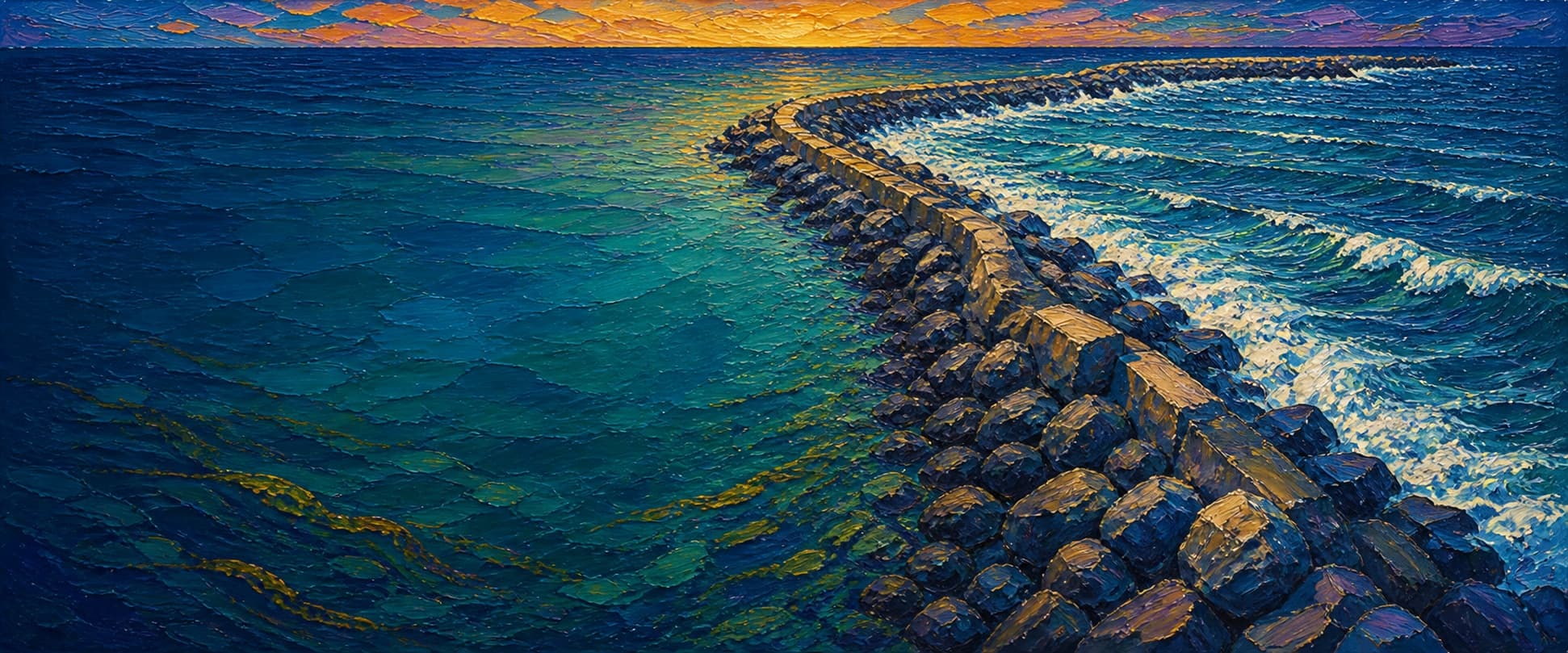
King Harbor Breakwater (North Breakwater)
Redondo Beach, California


Fishing conditions
Loading…
National Weather Service (api.weather.gov)
Loading…
NOAA CO-OPS predictions, station 9410738
- Sunrise—
- Sunset—
Dawn/dusk and a moving tide (the hour around a high or low) typically bring the most active bite — worth timing a trip around whichever falls closest to first/last light.
Loading…
Loading buoy telemetry…
NOAA National Data Buoy Center
A shore-connected, permeable rubble-mound north breakwater protecting King Harbor. The 1990 CERC/USACE report gives the physical north breakwater as 4,285 ft; the mapped OSM footprint is a long curved/L-shaped structure with a northern land connection and a southern head at the harbor entrance. It has no ordinary deck or railing, and the adjacent Redondo Canyon/high-energy wave environment makes the rock crest a serious hazard.
Species & regulations
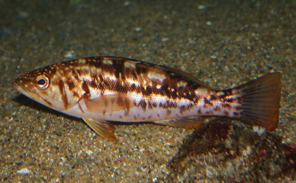
Small swimbaits, plastics or live bait fished tight to riprap; structure habitat is the key local pattern.
⚠ OEHHA Santa Monica Pier to Seal Beach Pier advisory: 1 serving/week for the listed women/children and adult groups; eat skinless fillet and follow the current poster.
Photo: Steve Lonhart / NOAA MBNMS · Public domain
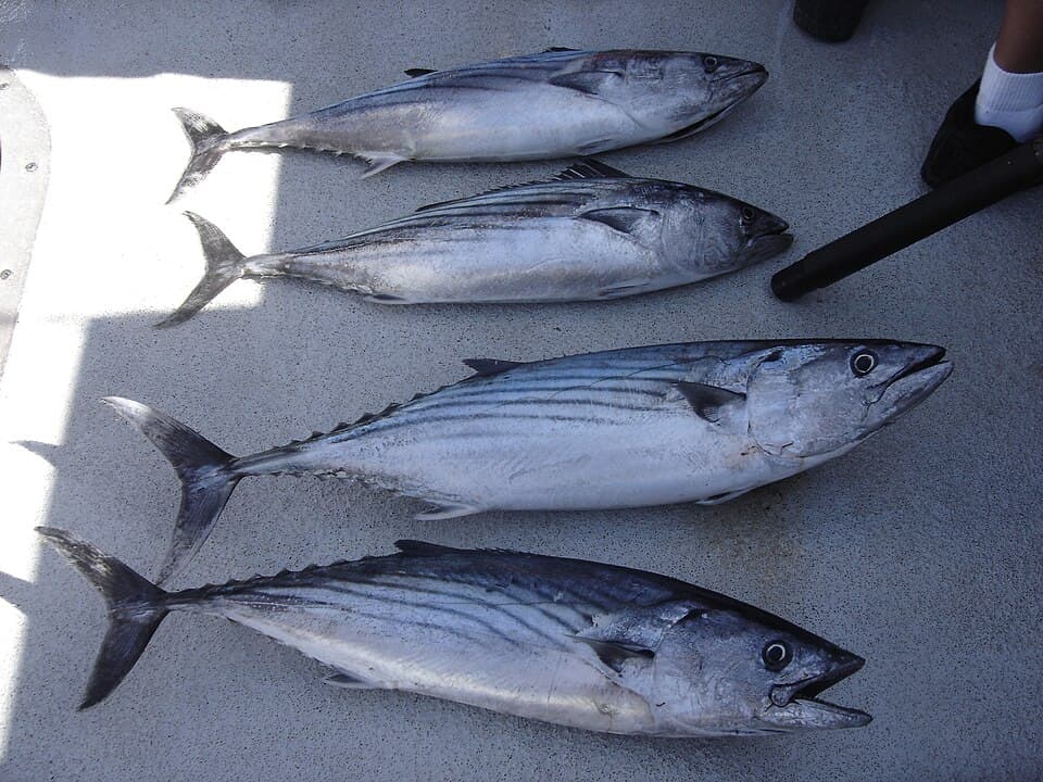
Surface iron, spoons, feathers or small baitfish when schools push past the head; local Redondo reports call out bonito, but waves limit safe access.
⚠ The site-specific Santa Monica-to-Seal Beach poster does not list bonito; check current OEHHA and CDFW guidance rather than inferring unrestricted consumption.
Photo: nmoorhatch via iNaturalist · CC BY 4.0
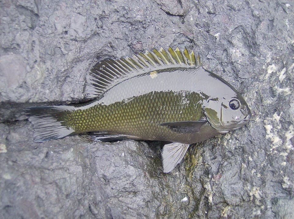
Mussels, algae/bread or small baits around sheltered, fouled riprap; do not climb the exposed face for them.
⚠ OEHHA site-specific advisory: 2 servings/week for both age/sex groups shown; follow the current poster.
Photo: Newtonsneurosci · CC BY-SA 4.0
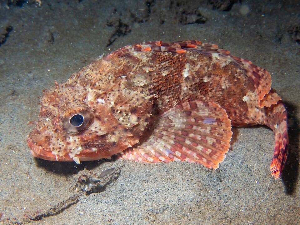
Squid, small fish or shrimp bounced on bottom beside rock; check current hook/gear rules whenever scorpionfish are aboard.
⚠ OEHHA site-specific advisory: 1 serving/week for the listed groups; eat skinless fillet and check the current advisory.
Photo: Mike Carr via iNaturalist · CC BY 4.0
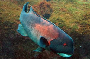
Crab, shrimp or mussel baits near deeper rock; structure species are documented in local King Harbor reports.
⚠ No separate sheephead line was found in the site-specific poster; use current OEHHA coastal guidance if keeping.
Photo: California Department of Fish and Wildlife · Public domain
Bag/size limits sourced from CDFW's ocean sport fishing regulations — always double-check the current CDFW regs before keeping fish, as rules change.
Moon tracker
Recommended spots
- Harbor entrance head
 Harbor entrance head / deepest water
USACE reports natural entrance depths around 34–40 ft and the NOAA chart shows deepening toward the head/Redondo Canyon, creating the strongest pelagic/deep-water structure potential. It also has the highest wave, current and boat-traffic risk.
- Inner dredged edge

 Harbor-side riprap / dredged edge
A real surveyed/dredged -18-ft MLLW corridor follows Area I stations 15+00–31+50. The rock-and-sediment edge offers structure potential and is more sheltered than the ocean face, but there is no guarantee that an angler can safely reach it.
- Mid-ocean faceSeaward rock slope / deepening toe
NOAA chart soundings deepen offshore and USACE repair design reaches about -25 ft MLLW on the seaward slope, giving substantial structure potential. Wave exposure is severe; this is not a safety recommendation.
- North bendShallow-to-mixed drop near shore connection
Shallower shoreward contours and a fouled rock-to-sand interface can suit opaleye, sargo and kelp bass. The rough approach and splashwall restrictions remain decisive constraints.
Landmarks
- North shore connection / splashwall
 access
USACE describes the breakwater as shore-connected and CDFW lists King Harbor Breakwater for public fishing, but the approach is rough riprap. Verify current access and city/Harbormaster signs; city code restricts walking or climbing on the splashwall.
- Moonstone Park vicinity
 amenity
Nearby public park/parking and harbor staging area; its proximity is not proof that the breakwater itself is open for entry.
- Area I inner dredged corridor
 structure
City/Coastal Commission plans show dredging along the harbor-side flank from roughly stations 15+00–31+50 to a design depth of -18 ft MLLW.
- Southern breakwater head / harbor entrance
 hazard
Deep-water entrance and exposed head with strong surge, current, navigation traffic and rapidly changing swell.
- Seaward riprap facehazard
USACE/CERC documents record high wave energy and serious injuries/deaths to fishermen on the breakwater. This is not a normal walking or wading surface.
- NOAA King Harbor tide stationamenity
NOAA subordinate station 9410738; use current predictions and local harbor warnings before any visit.
Rock + depth formation assessment
CDFW currently lists Redondo Beach/King Harbor Breakwater among public piers, jetties and breakwaters: a California ocean fishing license is not required when the structure is open and the angler remains on the qualifying breakwater, but all species rules still apply. This is a rough, wave-exposed rubble mound—not an elevated pier. CDFW's site plan says land access is best by boat and warns about safety; CDFW also says it cannot guarantee openings. Check current city/Harbormaster/USACE signage before entering; do not walk the crest, splashwall or rocks in swell.
The north breakwater is shore-connected and curves to a south head rather than forming a detached offshore reef. The inner/harbor flank has a real -18-ft MLLW dredged corridor (stations 15+00–31+50); chart soundings deepen toward the harbor entrance/head and outer face, but ocean-side zone boundaries are generalized from chart and engineering data. No invented point depths are implied.
A jetty's rock pile is the structure — there's no deck, just boulders stacked out into the water. Snags happen when your line or hook drops into a gap between rocks instead of open water. Rock sitting shallow, close to the surface, is the easiest to hang up on, and gets worse as the tide drops and exposes more of it. Rock that gives way to deeper water has less exposed structure to catch on, but a hook that does snag there is harder to pull free. Sandy gaps between rock sections are the clearest, lowest-snag water on a jetty.
The shallowest rock at King Harbor Breakwater (North Breakwater) sits on the channel-facing flank near the base — that's the highest snag risk here, and it gets worse as the tide drops and exposes more of it. 1 zone here hasn't been depth-assessed yet — treat that one as unknown, not clear.
- Channel-facing flank · unverifiednot yet assessed for snag risk
No reliable rock-toe depth classification was independently verified for this interval.
- Channel-facing flank · shallow bouldershallow rock, highest snag risk — worse as the tide drops
Shoreward/inner approach with mapped riprap and shallower contours; no exact current depth assigned.
- Channel-facing flank · mixed drop · ~18 ftrock into a slope, moderate snag risk
Engineering survey/dredging Area I follows stations 15+00–31+50; design depth -18 ft MLLW with -20 ft allowable overdredge.
- Channel-facing flank · deep water · ~30 ftdeep water at the rocks, less exposed but harder to free gear
NOAA/USACE sources put the entrance in roughly 27–40 ft; generalized along the protected side toward the entrance, not a point sounding.
- Ocean-facing flank · mixed drop · ~25 ftrock into a slope, moderate snag risk
NOAA chart soundings step from roughly 2–5 fathoms; USACE repair design reaches -25 ft MLLW on the seaward slope. Approximate only.
- Ocean-facing flank · deep water · ~40 ftdeep water at the rocks, less exposed but harder to free gearWave run-up
Chart soundings increase toward the head/Redondo Canyon; use as a broad zone, not an exact spot depth, and expect large swell.
- Outer tip · deep water · ~40 ftdeep water at the rocks, less exposed but harder to free gearWave run-up
Entrance/head zone; CERC/USACE reports natural entrance depths of 34–40 ft. Head/current/wave hazard dominates.

Reference sources
- CDFW beach fishing and public pier/breakwater access
- CDFW Los Angeles–Long Beach Area Contingency Plan, site 5-160
- USACE Redondo Beach navigation project
- USACE CERC-90-7 Redondo Beach Harbor engineering report
- USACE/Texas A&M CERC-90-6 technical report
- California Coastal Commission King Harbor dredging exhibits
- USACE King Harbor maintenance-dredging public notice
- City of Redondo Beach dredging completion report
- NOAA nautical chart 18746 (King Harbor)
- NOAA King Harbor tide station 9410738
- OpenStreetMap North King Harbor Breakwater way 1363827161
- Redondo Beach Biological Resources Assessment, Appendix D1
- EPA Southern California Coastal Marine Fish Contaminants Survey
- OEHHA Santa Monica Beach to Seal Beach Pier fish advisory
- CDFW Southern California ocean sport-fishing regulations
- CDFW general ocean-fishing regulations
- Pier Fishing in California: Redondo/King Harbor local history
- City of Redondo Beach municipal code (splashwall restrictions)
- Kelp bass image (Wikimedia Commons)
- Pacific bonito image (Wikimedia Commons)
- Opaleye image (Wikimedia Commons)
- California scorpionfish image (Wikimedia Commons)
- California sheephead image (Wikimedia Commons)