
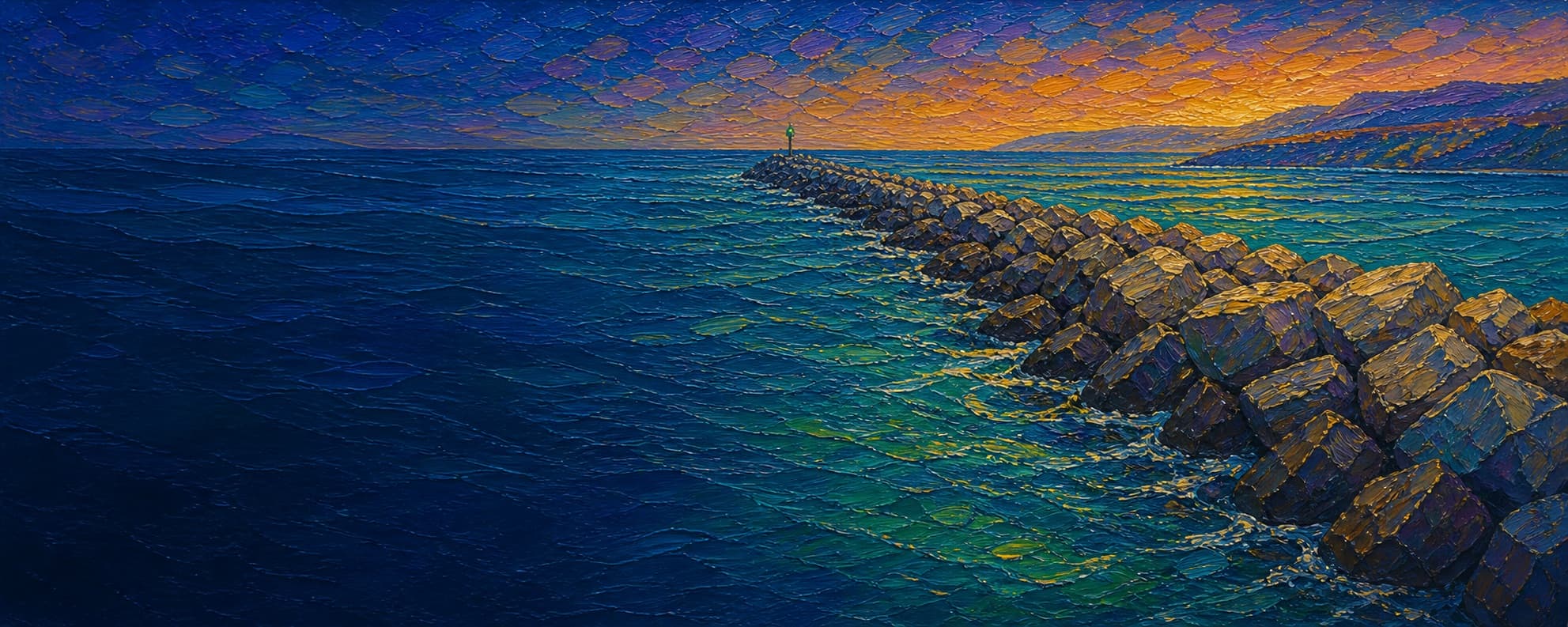
Dana Point Harbor Jetty (long west breakwater)
Dana Point, California


Fishing conditions
Loading…
National Weather Service (api.weather.gov)
Loading…
NOAA CO-OPS predictions, station TWC0419
- Sunrise—
- Sunset—
Dawn/dusk and a moving tide (the hour around a high or low) typically bring the most active bite — worth timing a trip around whichever falls closest to first/last light.
Loading…
Loading buoy telemetry…
NOAA National Data Buoy Center
Rubble-mound rock breakwater forming the long west/outer arm of Dana Point Harbor. It protects the harbor entrance and recreational marina from open-ocean swell; the outer end is lighted and the entrance between the two breakwaters is charted at about 20 ft. The rock walk is uneven and exposed, not an elevated pier deck.
Species & regulations
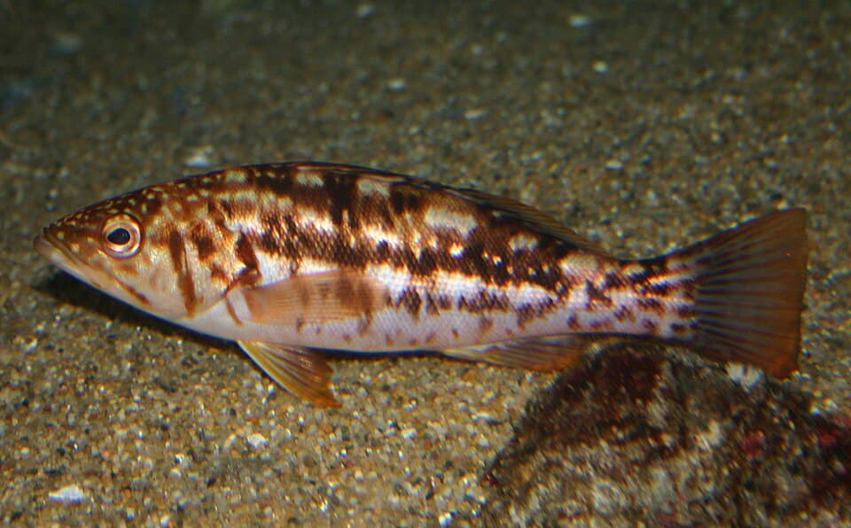
Small swimbaits, live sardine/anchovy or squid worked tight to the rock edge; keep casts clear of the deepest cracks to reduce snags.
⚠ OEHHA South of Seal Beach Pier to San Mateo Point: no more than 1 serving/week for women 18–49 and children 1–17, and 1 serving/week for women 50+ and men 18+; remove skin/fat and cook so juices drain.
Photo: Steve Lonhart / Monterey Bay National Marine Sanctuary · Public domain (NOAA/SIMoN)
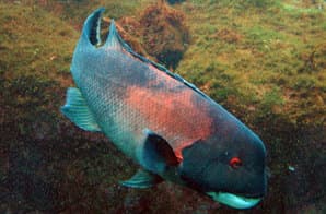
Squid, shrimp or mussel baits fished on the bottom beside larger rocks; handle the sharp teeth and dorsal spines carefully.
Photo: Magnus Kjaergaard · CC BY-SA 2.5
Live smelt/sardine, squid strip or a small swimbait along the sandy pocket and harbor-side edge; let the bait reach bottom before a slow retrieve.
⚠ OEHHA South of Seal Beach Pier to San Mateo Point: 2 servings/week for women 18–49 and children 1–17; 2 servings/week for women 50+ and men 18+.
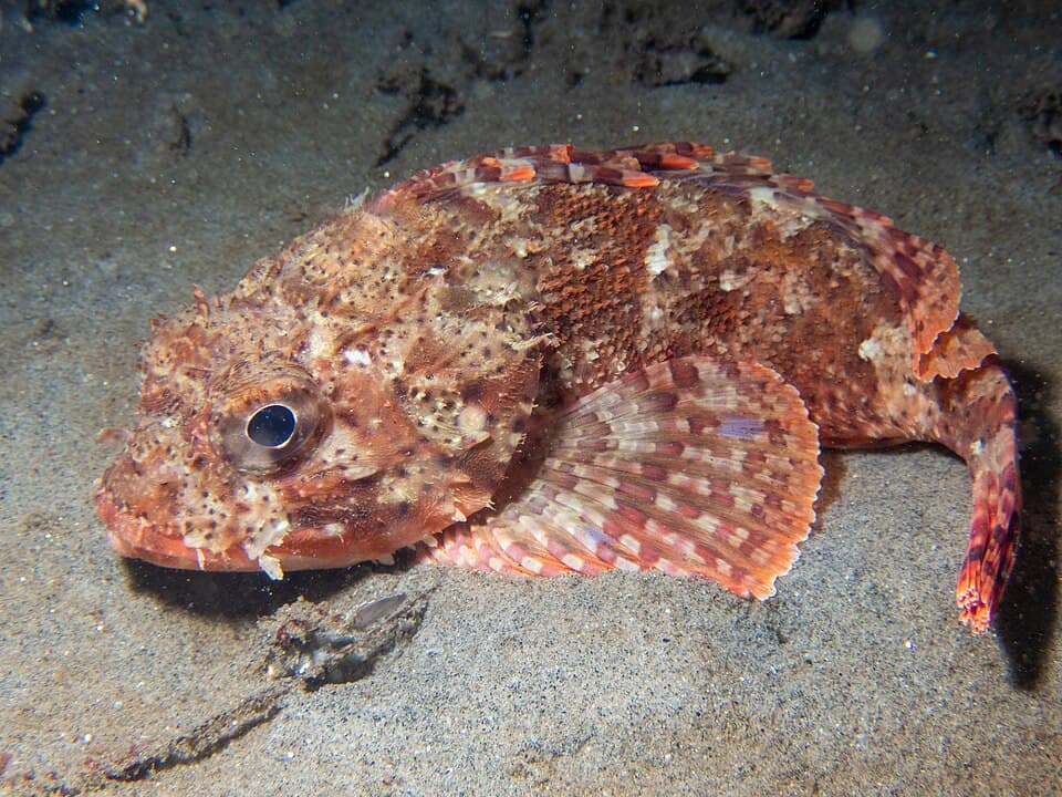
Squid or shrimp on a bottom rig beside the rock toe; use pliers and avoid the venomous spines when unhooking.
⚠ OEHHA South of Seal Beach Pier to San Mateo Point: 1 serving/week for women 18–49 and children 1–17, and 1 serving/week for women 50+ and men 18+.
Photo: Mike Carr (iNaturalist) · CC BY 4.0
Small jigs or squid/shrimp on a light bottom rig around deeper rock seams; release unidentified or prohibited rockfish immediately and follow current identification rules.
⚠ OEHHA South of Seal Beach Pier to San Mateo Point: 1 serving/week for women 18–49 and children 1–17; 2 servings/week for women 50+ and men 18+.
Sand crabs, mussel, bloodworm or small soft plastics along the sandy pocket and beach/rock transition near the base.
⚠ OEHHA South of Seal Beach Pier to San Mateo Point: 2 servings/week for women 18–49 and children 1–17, and 2 servings/week for women 50+ and men 18+.
Bag/size limits sourced from CDFW's ocean sport fishing regulations — always double-check the current CDFW regs before keeping fish, as rules change.
Moon tracker
Recommended spots
- Seaward flank around the two-thirds mark
 Ocean-facing rock structure
Local Dana Point jetty reports call the ocean side around two-thirds of the way out the best section, with calico bass, rockfish, perch and related structure fish reported. It is also the most exposed and sketchy section, so the rating is for fishability—not ease or safety.
- Outer entrance rocks

 Entrance drop / exposed end
Near the lighted outer approach, the two-breakwater entrance is the deepest documented part of the immediate structure (about 20 ft in the Coast Pilot). The water is moving and exposed here; fish the edges only while maintaining a clear escape route.
- Harbor-facing mid-jettyProtected harbor flank
The harbor side is calmer than the ocean side and local reports mention barred/sand bass and small halibut there, but boat traffic and moored-boat activity make this a watch-the-water spot rather than an unrestricted cast zone.
- Sandy pocket beside the baseSandy pocket between rock and beach
The beach/rock transition is the most plausible place to work surfperch or halibut with bait along a sand gap, while remaining nearer the access end. This is an imagery-and-structure rationale, not a claim of a guaranteed fish-holding depression.
- Headlands-side base rocksShallow boulder / access end
Closest to the Ocean Institute approach and adjacent rocky headlands/tide-pool habitat, but the base is shallow and exposed to wash. Use only on a calm, low-swell day and keep casts short around the irregular boulders.
Landmarks
- Ocean Institute / jetty base access
 access
CDFW's Dana Point Jetty map point is here. The Ocean Institute and harbor-road parking are the practical headlands-side approach; confirm current signs and any closure before crossing the rocks.
- Dana Point Harbor Fishing Pier
 structure
Separate public fishing pier near the Ocean Institute/Pilgrim replica; useful fallback when the rock walk is unsafe, but it is not part of this jetty object.
- Pilgrim replica / harbor-road end parking
 amenity
Public parking and the Pilgrim replica are the access landmarks described for Dana Point Headlands Beach; parking availability and restrictions vary by day.
- Dana Point Headlands Beach covered stair crossingaccess
A short covered stairway crosses the jetty rock pile to the beach. This is a route/access landmark, not a guarantee that every outer rock is safe to traverse.
- Outer breakwater light / harbor entrance
 hazard
Exposed outer end near the navigational entrance. NOAA warns of heavy-swell and low-tide hazards around the entrance; keep clear of vessels and retreat if waves wash the crest.
- Dana Point Jetty South (Doheny-side structure)structure
CDFW's second Dana Point record. It is the other harbor-mouth jetty, but CDFW notes that the adjacent rock wall touching land requires a fishing license; do not treat the whole land-connected wall as license-free.
Rock + depth formation assessment
CDFW lists Dana Point Jetty as a public fishing jetty, and Dana Point Harbor guidance permits shore fishing from the outermost jetties without a license. CDFW separately notes that the adjacent rock wall touching land at Dana Point Jetty South requires a license. All size, bag, season, MPA and gear rules still apply; CDFW also warns that a listed structure can be closed for safety or maintenance.
The long jetty is a continuous rock pile with a protected harbor-facing flank and an exposed ocean-facing flank. The outer end meets the two-breakwater entrance, where NOAA's Coast Pilot gives an entrance depth of about 20 ft. NOAA's Bathymetric Data Viewer, the NCEI Dana Point hydrographic survey archive and the USGS Southern California 1-m topobathymetric model are the appropriate next sources for point soundings; this draft does not assign approximate depths because I did not extract a defensible sounding at each zone.
A jetty's rock pile is the structure — there's no deck, just boulders stacked out into the water. Snags happen when your line or hook drops into a gap between rocks instead of open water. Rock sitting shallow, close to the surface, is the easiest to hang up on, and gets worse as the tide drops and exposes more of it. Rock that gives way to deeper water has less exposed structure to catch on, but a hook that does snag there is harder to pull free. Sandy gaps between rock sections are the clearest, lowest-snag water on a jetty.
The shallowest rock at Dana Point Harbor Jetty (long west breakwater) sits on the ocean-facing flank near the base — that's the highest snag risk here, and it gets worse as the tide drops and exposes more of it.
- Channel-facing flank · mixed droprock into a slope, moderate snag risk
Harbor-facing base beside the Ocean Institute/headlands access. Riprap meets protected harbor water; exact toe depth not confidently resolved from the available bathymetry documentation.
- Channel-facing flank · mixed droprock into a slope, moderate snag riskVessel traffic
Sheltered flank beside the harbor basin and approach channel. Use the visual rock edge as structure, not as a depth contour; vessel traffic is a practical hazard.
- Channel-facing flank · deep waterdeep water at the rocks, less exposed but harder to free gear
At the outer entrance, NOAA's Coast Pilot describes approximately 20 ft between the two breakwaters; no zone-specific point depth is claimed here.
- Ocean-facing flank · shallow bouldershallow rock, highest snag risk — worse as the tide drops
Near the headlands/base access, exposed rock and tide-pool/beach transition dominate. This is the shallowest visual character, but no numeric depth is asserted.
- Ocean-facing flank · mixed droprock into a slope, moderate snag risk
Long seaward flank with a rock-to-open-water edge and no confidently extracted point sounding. Local reports identify this mid-to-two-thirds section as the strongest structure-fishing water.
- Ocean-facing flank · deep waterdeep water at the rocks, less exposed but harder to free gearWave run-up
Outer tip is adjacent to the documented ~20-ft entrance, but swell and current can make the same rock unsafe to fish; do not interpret the category as a safety recommendation.
- Outer tip · deep waterdeep water at the rocks, less exposed but harder to free gear
Planning grid off the lighted tip. Category is based on the Coast Pilot's entrance description; numeric depth omitted because the source does not provide a tip-centered sounding.

Reference sources
- CDFW Public Fishing Piers and Jetties map
- CDFW ArcGIS public-pier feature query (Dana Point records and coordinates)
- Dana Point Harbor official fishing guidance
- OC Parks — Dana Point Harbor history
- U.S. Army Corps of Engineers — Dana Point Harbor 50th anniversary
- USACE annual report — Dana Point project dimensions (west/east breakwaters)
- NOAA Coast Pilot 7, Chapter 4 (Dana Point Harbor entrance)
- NOAA Bathymetric Data Viewer
- NCEI — H09274 Southwest of Dana Point hydrographic survey metadata
- USGS — Southern California and Channel Islands topobathymetric model
- USGS — Seamless high-resolution coastal DEM for Southern California
- Esri World Imagery basemap
- NOAA tide predictions — TWC0419 San Clemente subordinate station
- CDFW Southern Management Area current regulations
- CDFW recreational groundfish summary
- OEHHA — South of Seal Beach Pier to San Mateo Point advisory
- Ocean Institute — plan your visit (access and parking)
- California Beaches — Dana Point Headlands Beach access description
- Local Dana Point jetty angler report (structure, species, hazards)
- Wikimedia Commons — kelp bass image attribution
- Wikimedia Commons — California sheephead image attribution
- Wikimedia Commons — California scorpionfish image attribution