

Belmont Veterans Memorial Pier
Long Beach, California

Fishing conditions
Loading…
National Weather Service (api.weather.gov)
Loading…
NOAA CO-OPS predictions, station 9410670
- Sunrise—
- Sunset—
Dawn/dusk and a moving tide (the hour around a high or low) typically bring the most active bite — worth timing a trip around whichever falls closest to first/last light.
Loading…
Loading buoy telemetry…
NOAA National Data Buoy Center
T-shaped concrete pier, approximately 1,620 ft long and generally 26 ft wide. The seaward end enlarges into a hexagonal platform with east and west wings extending about 120 ft; the deck uses lightweight concrete and precast planks. A former end building housed concessions and lifeguard/restaurant uses, and the city has documented ongoing structural-renovation planning.
Species & regulations
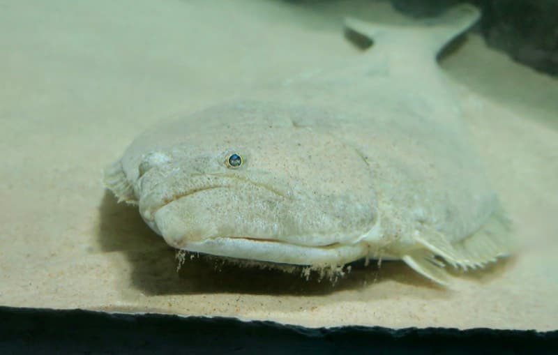
Live anchovy, smelt, sardine or mackerel fished close to the bottom around the mid-pier piling depressions.
⚠ OEHHA's Southern California advisory includes California halibut in its limited-consumption guidance; check the current OEHHA map and serving limits before eating locally caught fish.
Photo: RatioTile · CC BY-SA 4.0
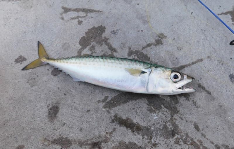
Sabiki or small strips of squid/mackerel around the outer wings when bait schools are present.
⚠ Check OEHHA's current Southern California advisory for serving limits on locally caught mackerel.
Photo: Ruff tuff cream puff · CC0
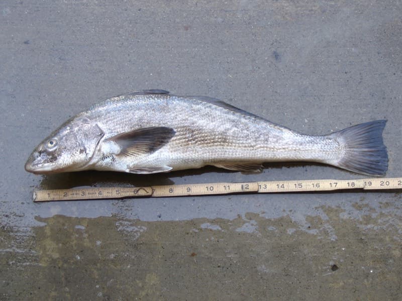
Sand crabs, fresh mussel or bloodworms in the shallow surf near the base, especially at dawn or dusk.
⚠ OEHHA consumption guidance applies to Southern California coastal fish; verify the current advisory before keeping bottom fish.
Photo: N1ywb · CC BY-SA 3.0
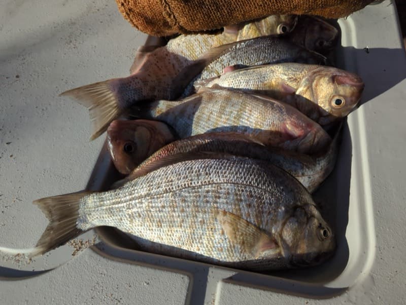
Small hooks baited with mussel, sand crab or bloodworm near pilings and the inshore sand.
⚠ Older local guidance warns of DDT/PCB contamination in Southern California surfperch; consult the current OEHHA advisory before eating.
Photo: Matt Muir (iNaturalist) · CC BY 4.0
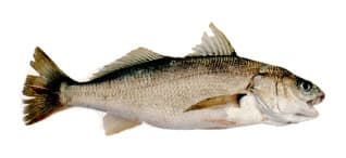
Bottom bait such as squid or mussel; common on the local report but usually better treated as catch-and-release.
⚠ OEHHA's Southern California DDT/PCB advisory identifies a do-not-consume region for white croaker extending from south of Santa Monica Pier to Seal Beach Pier, which includes Belmont Pier.
Photo: Milton Love, Marine Sportfish Identification · Public domain
Bag/size limits sourced from CDFW's ocean sport fishing regulations — always double-check the current CDFW regs before keeping fish, as rules change.
Moon tracker
Recommended spots
- Mid-pier piling depressions
 Bottom / halibut and sand bass
Pier Fishing in California identifies the middle of the pier as the best area for California halibut and sand bass, along with walleye surfperch, jacksmelt, tomcod and diamond turbot. Work live or cut bait near, but not into, the concrete-pile line.
- Inshore surf zone

 Surfline / croaker and corbina
The local pier report recommends the inshore surf for larger spotfin and yellowfin croaker and California corbina, especially early and late in the day. Sand crabs, mussel, ghost shrimp, or bloodworms are the documented bait choices; this is shallow, wave-affected water.
- Bait-shop and landing pilingsMussel-covered structure
The local guide says the area near the bait shop and boat landing is best for sargo and queenfish, and that mussel-covered pilings can produce blackperch, rubberlip perch and pileperch. Fish close to structure with fresh mussel or ghost shrimp while avoiding snags and dock traffic.
- Outer T-end wingsPelagic / open-water rail
The wide end is the report's preferred area for sardines, Pacific and jack mackerel, jacksmelt and occasional bonito, barracuda and sharks. Use Sabiki rigs or small strips of squid/mackerel; crowding and posted closures can make the rail unavailable.
Landmarks
- Pier entrance — 39th Place and Ocean Boulevard
 access
Shore-end access at the Belmont Shore/Belmont Heights beachfront; the city lists the address as 35 39th Place.
- Belmont Pier parking lot
 amenity
Paid lot and nearby metered/free street parking are documented by local pier guides; hours and fees can change.
- Bait and tackle/snack shopamenity
City and local fishing guides describe a bait/snack concession on the pier; Pier Fishing in California notes it is often closed, so bring backup bait.
- Fishing-boat landing / AquaLink dock area
 structure
The city describes a storm-damaged fishing-boat landing restored in the 2000s and Long Beach Transit AquaLink service near the pier; keep casts clear of any active dock or landing operations.
- Hexagonal T-end and east/west wingsstructure
Widest fishing platform and the documented location for sport fishing access; renovation closures or fencing may alter access.
Vegetation / growth assessment
The best local description is an open sandy/muddy bottom with little seaweed or kelp growth around the pier, but fairly heavy mussel growth on the pilings. I found no authoritative, current source that maps a persistent surface kelp canopy or distinguishes vegetation by flank, so the zones below are conservative light baselines with a moderate pile-fouling note rather than a claim of mapped canopy.
Piers grow algae, mussels, and barnacles on their pilings and along the deck edges over time — that build-up is what this section tracks. The more growth in a stretch, the easier it is for your hook, sinker, or line to catch on it and get stuck, which is one of the most common ways beginners lose tackle. Heavier growth isn't a reason to avoid a spot — it often holds bait and structure fish like — just expect to snag more and re-tie more often there.
The most growth on Belmont Veterans Memorial Pier is on the left flank, mid-structure and the right flank, mid-structure — expect occasional snags there; nothing else on the structure reads heavier.
- Left flank · noneunconfirmed, not yet assessed
No flank-specific vegetation observation was independently verified here; gridded as checked, none confirmed.
- Left flank · noneunconfirmed, not yet assessed
No flank-specific vegetation observation was independently verified here; gridded as checked, none confirmed.
- Right flank · noneunconfirmed, not yet assessed
No flank-specific vegetation observation was independently verified here; gridded as checked, none confirmed.
- Right flank · noneunconfirmed, not yet assessed
No flank-specific vegetation observation was independently verified here; gridded as checked, none confirmed.
- Left flank · moderatemoderate growth, expect occasional snags
Moderate subsurface biofouling is plausible because the local report documents heavy mussels on pilings; no flank-specific survey was available.
- Right flank · moderatemoderate growth, expect occasional snags
Same conservative piling estimate; the source does not establish a left/right difference.
- Outer end · lightsome growth, light snag risk
Outer platform is described as sand/mud with little kelp; localized pile fouling may still occur under the T-end.

Reference sources
- City of Long Beach — Belmont Veterans Memorial Pier
- City of Long Beach — Belmont Veterans Memorial Pier Enhancements
- Pier Fishing in California — Belmont Veterans Memorial Pier
- Apple Maps — Belmont Veterans Memorial Pier coordinates
- Wikidata — Belmont Veterans Memorial Pier coordinate
- NOAA Tides & Currents — Long Beach Pier F station 9410670
- NOAA CO-OPS station list
- CDFW — General ocean fishing regulations
- CDFW — 2026 California Ocean Sport Fishing Regulations
- CDFW Marine — public pier license exemption
- OEHHA — Southern California fish consumption advisory
- CDFW — Aerial Kelp Surveys