
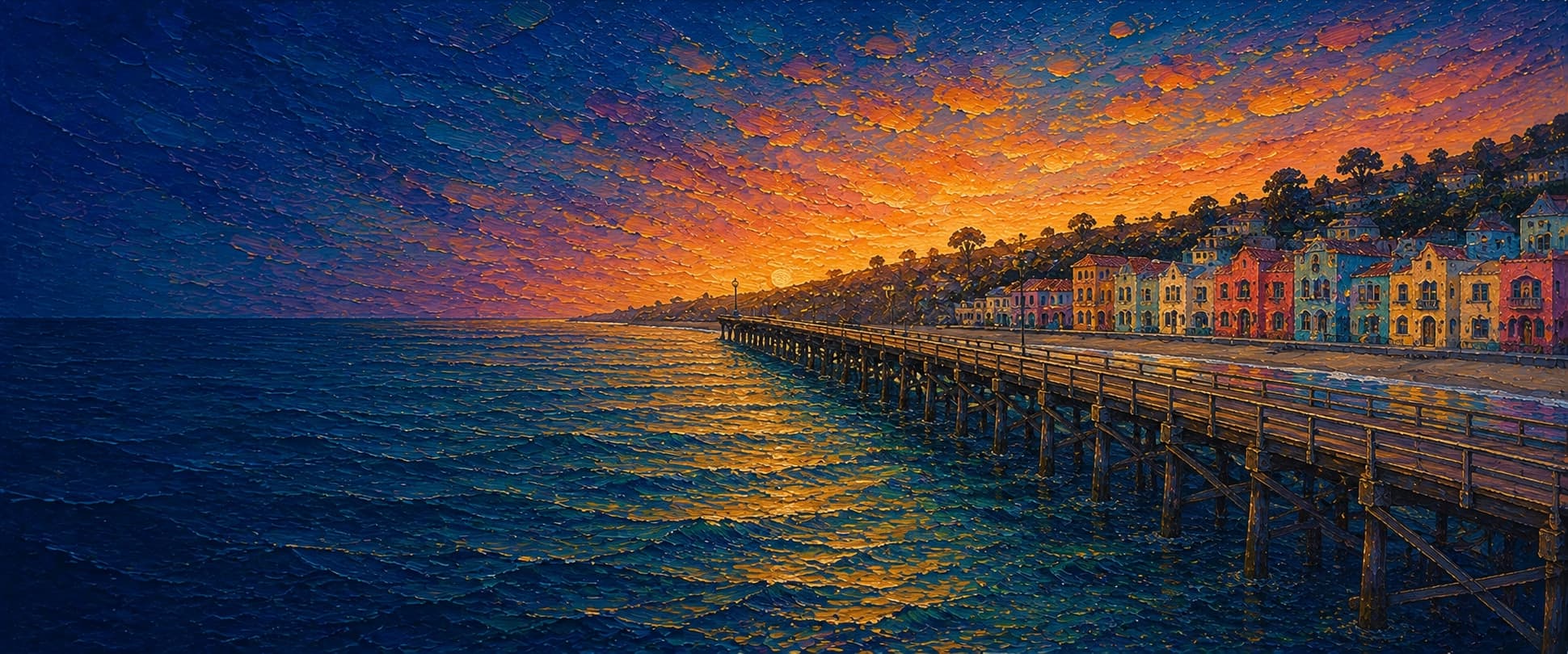
Capitola Wharf
Capitola, California
Fishing conditions
Loading…
National Weather Service (api.weather.gov)
Loading…
NOAA CO-OPS predictions, station 9413745
- Sunrise—
- Sunset—
Dawn/dusk and a moving tide (the hour around a high or low) typically bring the most active bite — worth timing a trip around whichever falls closest to first/last light.
Loading…
Loading buoy telemetry…
NOAA National Data Buoy Center
Historic Capitola wharf projecting into Soquel Cove/Monterey Bay from Wharf Road between Capitola City Beach and Hooper Beach. The current public deck is a straight wharf without a T-end, rebuilt and widened from about 20 ft to 36 ft during the 2023-2024 resiliency project. Official project/reopening materials describe new pressure-treated Douglas fir decking, new railings, repairs and replacement to 148 piles, a new entrance gate, permanent public restrooms, mounted viewing/binocular stations, interpretive signage, a fish-cleaning station, and a boat-launch area.
Species & regulations
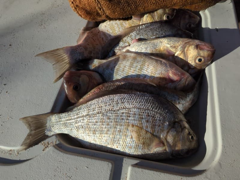
Sand crabs, pile worms, fresh mussel, market shrimp, or small grubs in the base surf and along the piling line.
Photo: Matt Muir (iNaturalist) · CC BY 4.0
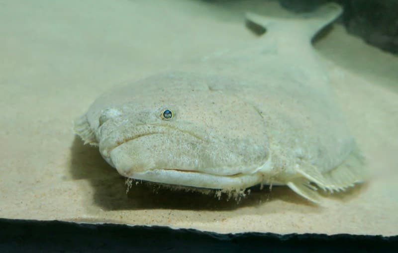
Live anchovy, smelt, sardine, or small mackerel near bottom from just outside the breakers to mid-wharf; artificials also work when bait is present.
Photo: RatioTile · CC BY-SA 4.0
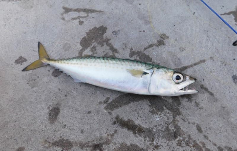
Sabiki or Lucky Lura-style bait rigs, small strips of squid, or small metals at mid-depth near the outer end when bait schools sweep through.
Photo: Ruff tuff cream puff · CC0 (public domain dedication)
Small bait rigs or lightly baited hooks under a float through the upper water column, especially around the outer half of the wharf.
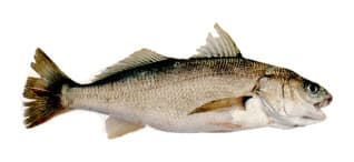
Cut anchovy or small squid strips fished on the bottom from almost any part of the outer wharf; locally one of the most common catches.
⚠ OEHHA's statewide advisory for California coastal locations without site-specific advice recommends limiting white croaker meals: women 18-45 and children 1-17 up to 2 servings/week, women 46+ and men 18+ up to 4 servings/week.
Photo: Milton Love, Marine Sportfish Identification · Public domain
Bag/size limits sourced from CDFW's ocean sport fishing regulations — always double-check the current CDFW regs before keeping fish, as rules change.
Moon tracker
Recommended spots
- Mid-to-outer piling line
 Structure edge
This is the classic Capitola structure water: the local report says the pilings carry mussels and often seasonal kelp, attracting perch, small rockfish, cabezon, and bait. It offers the best mix of fish-holding cover and casting room if you can manage snags.
- Base surf zone

 Shallow surf
The local Capitola report calls the surf area one of the wharf's most reliable zones, especially on an incoming tide, for barred and calico surfperch. This is the clearest shallow-water option for sand crabs, worms, or light grubs.
- Just past the breakersSandy transition water
Pier Fishing in California identifies the water from outside the surf to about mid-wharf as a prime halibut zone, with striped bass showing when bait crowds the wharf. It is still shallow enough for active bait movement but deeper and less churned than the base.
- Outer end railDeepest open water
The wharf end is the usual zone for mackerel, jacksmelt, white croaker, sharks, and rays. It lacks the piling/kelp concentration of the mid-outer structure edge but gives the broadest access to deeper, more open water.
Landmarks
- Wharf Road / main wharf gate
 access
Main landward access at the foot of Wharf Road. The California Coastal Trail point marks this as the public access/fishing-wharf entry.
- Public restrooms and fish-cleaning area
 amenity
Official 2024 rebuild materials place the new permanent restrooms near the wharf entrance and describe a fish-cleaning station as part of the reopened public-access improvements.
- Capitola City Beachamenity
Mapped beach immediately on the south side of the wharf approach; the shallow surf zone here is the natural base-area fishing water.
- Boat-launch / service area on the wharf
 structure
The 2024 reconstruction added a new boat-launch area. Exact rack/hoist placement was not separately mapped, so this point is approximate along the wharf footprint.
- Outer wharf head / deepest public railstructure
End of the wharf footprint and the deepest publicly fishable rail. Good reference point for spotting current, bait schools, and swell exposure.
- Outer piling and kelp line
 hazard
Local fishing reports describe mussel-encrusted pilings and seasonal kelp around the outer half of the wharf. Productive fish-holding structure, but also the main snag zone.
Vegetation / growth assessment
Local fishing documentation describes a fair buildup of mussels on the pilings and often a fairly thick buildup of kelp around the wharf from midsummer into fall, especially from mid-wharf outward. The 2024 rebuild replaced most decking/railings and repaired or replaced many piles, but I did not find a current citable imagery or habitat survey showing exact side-specific fouling after reconstruction, so these zones are generalized and intentionally low-confidence.
Piers grow algae, mussels, and barnacles on their pilings and along the deck edges over time — that build-up is what this section tracks. The more growth in a stretch, the easier it is for your hook, sinker, or line to catch on it and get stuck, which is one of the most common ways beginners lose tackle. Heavier growth isn't a reason to avoid a spot — it often holds bait and structure fish like — just expect to snag more and re-tie more often there.
The most growth on Capitola Wharf is on the left flank, mid-structure, the right flank, mid-structure, and the outer end — expect occasional snags there; nothing else on the structure reads heavier.
- Left flank · noneunconfirmed, not yet assessed
Shallow surf interval checked conceptually from source descriptions; no citable evidence of persistent kelp/fouling concentration this close to shore.
- Right flank · noneunconfirmed, not yet assessed
Same shallow base interval on the opposite flank; treated as checked but unconfirmed for notable vegetation concentration.
- Left flank · moderatemoderate growth, expect occasional snags
Generalized seasonal kelp/piling-growth zone from the local fishing report; exact post-2024 side dominance was not independently verified.
- Right flank · moderatemoderate growth, expect occasional snags
Mirrors the same cautionary interpretation on the opposite side because the report describes kelp around the pier generally, not a single measured flank.
- Outer end · moderatemoderate growth, expect occasional snags
Approximate width based on the rebuilt wharf's reported 36-ft deck width. Included because the end sits in the same documented midsummer-to-fall kelp/fouling water.

Reference sources
- City of Capitola — Capitola Wharf Present
- City of Capitola — Capitola Wharf Resiliency Project
- City of Capitola — Historical Snapshots 1800s
- Capitola Village BIA — Historic Capitola Wharf
- Visit Santa Cruz County — Historic Capitola Wharf Reopens Following $10 Million Renovation
- California Coastal Trail — Capitola Fishing Wharf
- Pier Fishing in California — Capitola Wharf
- OpenStreetMap Nominatim — Capitola Wharf search
- Overpass API — Capitola Wharf OSM way 29545612 geometry
- NOAA CO-OPS metadata API — tide prediction stations
- NOAA Tides & Currents — Santa Cruz, Monterey Bay station 9413745
- CDFW — California Beach Fishing / public pier guidance
- CDFW — California Recreational Ocean Fishing Regulations
- CDFW — Current California Ocean Recreational Fishing Regulations, Central Region
- CDFW — Current California Ocean Recreational Fishing Regulations, San Francisco Region
- CDFW — Marine Fish Identification Quiz (white croaker bag limit note)
- OEHHA — Statewide Advisory for Eating Fish from California Coastal Locations without Site-Specific Advice