
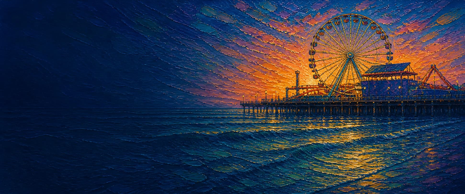
Santa Monica Pier (Municipal and Newcomb pier complex)
Santa Monica, California

Fishing conditions
Loading…
National Weather Service (api.weather.gov)
Loading…
NOAA CO-OPS predictions, station 9410840
- Sunrise—
- Sunset—
Dawn/dusk and a moving tide (the hour around a high or low) typically bring the most active bite — worth timing a trip around whichever falls closest to first/last light.
Loading…
Loading buoy telemetry…
NOAA National Data Buoy Center
This is not a simple single-deck pier: the historic complex joins the long, narrow 1909 Municipal Pier with the broader early-1920s Newcomb/Pleasure-Pier area. City historic-context material records the Municipal Pier's 1908–09 experimental concrete-and-steel construction, followed by a 1921 traditional-timber reconstruction, widening, and extension to nearly 1,600 ft. The broad shoreward/central deck carries Pacific Park rides; the historic 1916 Looff Hippodrome (Carousel Building) stands at the foot of the pier. The 1983 storms destroyed the west end, and the restoration completed in 1990; Pacific Park opened in 1996.
Species & regulations
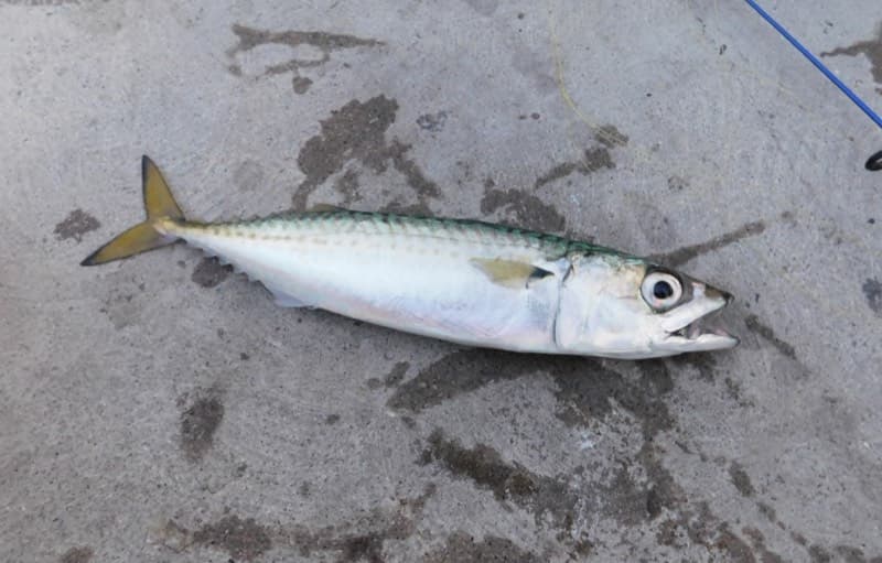
Use a small baited multi-hook rig or a small strip of squid through the water column at the end; the local report identifies the end as the pier's strongest mackerel area.
⚠ OEHHA: up to 2 servings/week for women 18–49 and children 1–17; up to 4 servings/week for women 50+ and men 18+ (eat skinless fillet).
Photo: Ruff tuff cream puff · CC0 1.0
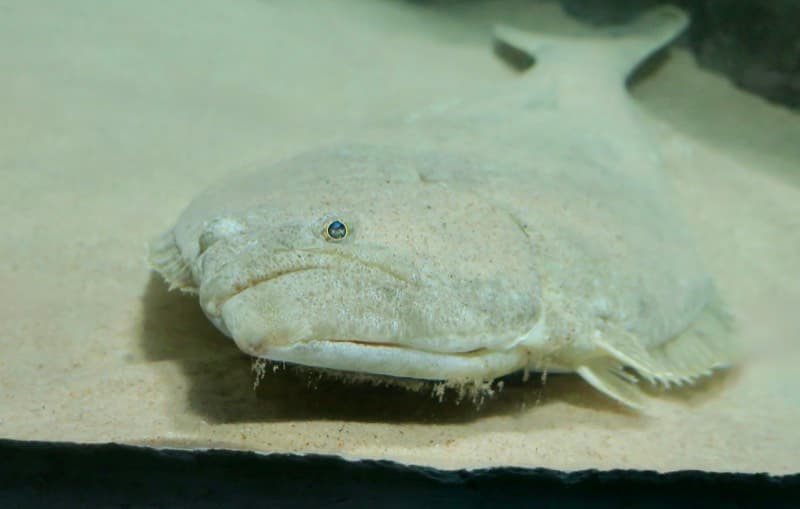
Fish a legal live bait or a natural-bait rig near the sandy bottom in the mid-pier water; local reporting calls this the usual best section for halibut.
⚠ OEHHA: up to 1 serving/week for women 18–49 and children 1–17; up to 2 servings/week for women 50+ and men 18+ (eat skinless fillet).
Photo: RatioTile · CC BY-SA 4.0
Use small hooks with mussel, worm, or sand-crab bait in the shallow south-side water or carefully near pilings; the report places larger perch around the piling walkways.
⚠ OEHHA: up to 2 servings/week for both advisory groups (eat skinless fillet).
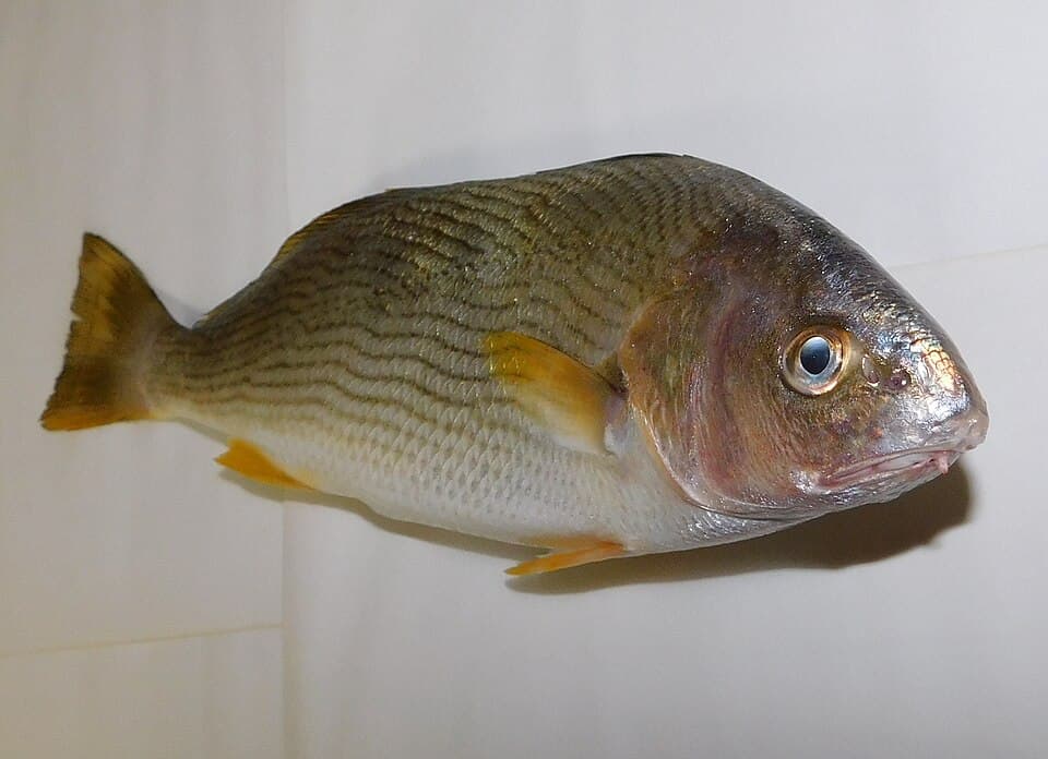
Small high/low rigs with sand crabs, mussel, worms, or shrimp in the permitted shallow south-side rail water.
⚠ OEHHA: up to 2 servings/week for both advisory groups (eat skinless fillet).
Photo: Ruff tuff cream puff · CC0 1.0
Fish fresh mussel, ghost shrimp, or worms on small hooks near the pile structure; the Santa Monica report specifically identifies larger sargo around the under-pier walkways.
⚠ OEHHA: up to 1 serving/week for both advisory groups (eat skinless fillet).
Small pieces of bait on a controlled bottom or mid-depth presentation will catch them in mid-pier water; release rather than retain under the location-specific advisory.
⚠ OEHHA: do not eat white croaker from Santa Monica Beach south of Santa Monica Pier to Seal Beach Pier, for either advisory group, due to mercury, DDT, or PCBs.
Bag/size limits sourced from CDFW's ocean sport fishing regulations — always double-check the current CDFW regs before keeping fish, as rules change.
Moon tracker
Recommended spots
- Outer end rail
 Deepest water / pelagic rail
The local pier report places the largest numbers of mackerel, occasional bonito, and larger sharks and bat rays at the end. It is the clearest casting-water option when open, but expect crowds and honor any active restaurant or safety controls.
- Mid-pier open rail

 Mid-depth sandy bottom
Pier Fishing in California calls mid-pier the usual best halibut area, while also reporting jacksmelt and mackerel in the upper water and white croaker/queenfish on bottom. Fish a legal bait rig near, rather than through, the piling line.
- Under-pier walkway / piling edgePiling structure
The reconstruction's under-pier walkways give unusual access to pile structure, where the report places larger perch, perch-like fish, and sargo. This is structure fishing: use a controlled presentation and avoid the documented old-pier snag pockets.
- South-side inshore railShallow surf water
The local report says fishing near the shore businesses is restricted to the south side, but calls these limited inshore waters the best area for surf species such as corbina and croakers. It is shallower and more pedestrian-constrained than mid-pier or the end.
- Harbor Patrol/restroom transitionStructure transition
A regular angler quoted in the local report calls the water immediately before the bathrooms and Harbor Patrol office productive, but explicitly warns that old-pier pieces snag bottom rigs on both sides. Worth a careful suspended presentation, not a blind bottom cast.
Landmarks
- Colorado Avenue / Route 66 pier entrance
 access
Main landward access at the foot of Colorado Avenue. The City venue page lists on-site elevators, restrooms, benches, bike racks, picnic tables, and Wi-Fi; current bridge construction can change the walking route.
- Looff Hippodrome (Carousel Building)
 structure
1916 carousel building at the foot of the pier, a City Landmark and National Register landmark. It is a historic building, not a fishing platform.
- Pacific Park / Newcomb-Pier deck
 amenity
Amusement-ride deck in the wider joined-pier area; Pacific Park opened in 1996. High visitor traffic and ride/building footprints constrain casting compared with the outer rail.
- Restrooms and Harbor Patrol areaamenity
Approximate mapped central location. A local pier report identifies fishing immediately before this area as productive, but also warns of nearby old-pier snags; verify access and posted restrictions.
- Outer end rail and end buildingstructure
Widest open outer platform and deepest water reached from the complex. Restaurant operations and rail access can change; fish only where current signs permit it.
- Submerged old-pier debris / snag risk
 hazard
Pier Fishing in California reports snags from parts of the old pier on either side of the Harbor Patrol/restroom area; avoid blindly fishing the bottom here.
Vegetation / growth assessment
Current Esri World Imagery shows an open-water/sandy-beach setting, wave foam, and dark water tonal variation but no unambiguous floating kelp canopy attached to the pier. Kelpwatch and CDFW aerial surveys are appropriate regional checks, but no site-level time series or multi-date image interpretation was completed here. Accordingly, the zones indicate a cautious low baseline only; they do not claim that piles lack algae, mussels, or other biofouling.
Piers grow algae, mussels, and barnacles on their pilings and along the deck edges over time — that build-up is what this section tracks. The more growth in a stretch, the easier it is for your hook, sinker, or line to catch on it and get stuck, which is one of the most common ways beginners lose tackle. Heavier growth isn't a reason to avoid a spot — it often holds bait and structure fish like — just expect to snag more and re-tie more often there.
Santa Monica Pier (Municipal and Newcomb pier complex)'s heaviest checked growth is still only light, on the left flank, mid-structure, the right flank, mid-structure, and the outer end — snag risk from vegetation is low across the structure right now.
- Left flank · noneunconfirmed, not yet assessed
No side-specific vegetation observation was independently verified here; gridded as checked, none confirmed.
- Right flank · noneunconfirmed, not yet assessed
No side-specific vegetation observation was independently verified here; gridded as checked, none confirmed.
- Right flank · noneunconfirmed, not yet assessed
No side-specific vegetation observation was independently verified here; gridded as checked, none confirmed.
- Left flank · lightsome growth, light snag risk
No distinct surface canopy can be verified along this flank in the reviewed current aerial crop; piling-scale fouling is below its resolution.
- Right flank · lightsome growth, light snag risk
Open water and wave/shadow variation are visible, but not enough multi-date evidence supports calling the dark tone vegetation.
- Outer end · lightsome growth, light snag risk
Outer-platform width is approximate from the mapped footprint. No confirmed floating canopy is assigned; this is a baseline, not a zero-vegetation finding.

Reference sources
- OpenStreetMap — Santa Monica Pier, way 22728853
- Nominatim — Santa Monica Pier mapped feature
- Esri World Imagery export used for aerial check
- City of Santa Monica — Pier venue and amenities
- City of Santa Monica — Historic Context Statement (pier history)
- City of Santa Monica — Santa Monica Pier history spotlight
- City of Santa Monica — current pier construction updates
- Pier Fishing in California — Santa Monica Pier
- Pier Fishing in California — Santa Monica Pier fish and locations
- Pier Fishing in California — Santa Monica Pier snag warning
- NOAA CO-OPS — Santa Monica station 9410840
- CDFW — public-pier license and gear rules
- CDFW — current Southern California ocean regulations
- CDFW — current general ocean finfish regulations
- CDFW — current ocean fishing regulations
- OEHHA — Santa Monica Pier to Seal Beach Pier advisory
- Kelpwatch — California kelp canopy map
- Kelpwatch — methodology
- CDFW — Aerial Kelp Surveys
- Wikimedia Commons — Pacific chub mackerel photo
- Wikimedia Commons — California halibut photo
- Wikimedia Commons — yellowfin croaker photo