
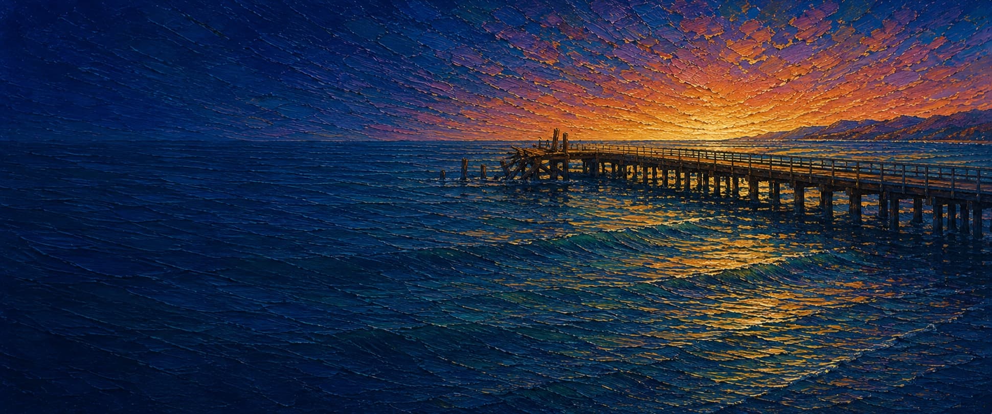
Gaviota Pier
Gaviota, California
Fishing conditions
Loading…
National Weather Service (api.weather.gov)
Loading…
NOAA CO-OPS predictions, station 9411340
- Sunrise—
- Sunset—
Dawn/dusk and a moving tide (the hour around a high or low) typically bring the most active bite — worth timing a trip around whichever falls closest to first/last light.
Loading…
Loading buoy telemetry…
NOAA National Data Buoy Center
Straight wooden pier, listed at 529 ft long, 21 ft wide, and about 18 ft above the water. It has a boat hoist and historically served anglers, divers, and small-boat users. The last roughly 100 ft collapsed during a March 1, 2014 storm; State Parks has kept the pier closed pending repair or reconstruction, so this is a historic layout rather than an assertion of present access.
Species & regulations
Live or fresh bait fished near the bottom; the local report identifies the sandy outer-surf to mid-pier area as the historical halibut zone.
Small Sabiki or bait rigs when schools are present; the local report says mackerel are most consistent toward the historic outer end.
Sand crabs, pile worms, bloodworms, fresh mussel, or clam in the shallow surf area.
Small hooks and bits of mussel or worm around the piling line; the report says shinerperch commonly saturate mid-pier to end water.
Fish fresh mussel or small live bait beside kelp and mussel-covered pilings when kelp is present; release undersized fish carefully.
Bag/size limits sourced from CDFW's ocean sport fishing regulations — always double-check the current CDFW regs before keeping fish, as rules change.
Moon tracker
Recommended spots
- Outer end (historic pelagic zone)
 Deepest water / pelagics and rays
The published depth at the end is approximately 20 ft, and the far end historically produced Pacific and jack mackerel, sardines, bonito, sharks, rays, and occasional thresher sharks. The last section collapsed and remains closed, so this rating is historical only.
- Outer-surf to mid-pier bottom

 Sandy bottom / halibut
Pier Fishing in California describes this as the main California-halibut area, with a mostly sandy bottom and water free of kelp in the outer-surf-to-mid-pier stretch. Historical productivity does not override the current closure.
- Mid-pier piling and kelp lineKelp / piling structure
The report documents mussel-covered pilings and says some years bring dense kelp around much of the pier. Perch, small rockfish, kelp bass, kelpfish, and sculpin are associated with this structure; kelp presence varies by year.
- Shallow surf zone at the baseSandy surf / surfperch
The local pier report identifies the inshore surf area as productive for barred surfperch, other perch, rays, guitarfish, and sharks. It is shallow and sandy, but this section is also within the long-standing closure footprint.
Landmarks
- Gaviota State Park day-use / beach access
 access
Park entrance, day-use parking, beach route, restrooms, showers, picnic tables, and park store are the documented shore-side amenities. Check the park's current closure notices before traveling.
- Pier closure and storm-damaged end
 hazard
The pier has been closed since the March 1, 2014 storm collapse; the final approximately 100 ft fell into the ocean. Do not cross barriers or fish from the structure unless State Parks reopens it.
- Gaviota Pier boat hoist
 structure
State Parks and California Coastal Commission documents identify the hoist as a major pier facility; it has remained closed with the pier since 2014.
- Southern Pacific railroad trestle / Gaviota Creekstructure
The park access route passes beneath the railroad trestle over Gaviota Creek. Winter flooding can affect the beach and access road.
- Kashtayit State Marine Conservation Area boundaryhazard
The pier borders Kashtayit SMCA. CDFW says recreational finfish fishing is permitted there, but MPA rules and species-specific regulations still apply; do not assume every invertebrate take is allowed.
Vegetation / growth assessment
The fishing report documents mussel-covered pilings and large year-to-year variation in kelp: some seasons show dense kelp around much of the pier, while others show little or none. No authoritative, date-stamped source reviewed here maps the present kelp or biofouling footprint by flank, so the assessment deliberately contains no zones.
Piers grow algae, mussels, and barnacles on their pilings and along the deck edges over time — that build-up is what this section tracks. The more growth in a stretch, the easier it is for your hook, sinker, or line to catch on it and get stuck, which is one of the most common ways beginners lose tackle. Heavier growth isn't a reason to avoid a spot — it often holds bait and structure fish like — just expect to snag more and re-tie more often there.
No dated, location-specific survey confirms current vegetation coverage on Gaviota Pier — every checked zone reads as unconfirmed rather than surveyed clear, so snag risk from growth here is unknown, not low, until a current review is available.
- Left flank · noneunconfirmed, not yet assessed
No date-matched pier-scale observation supports a current flank intensity; gridded as checked, none confirmed.
- Right flank · noneunconfirmed, not yet assessed
No date-matched pier-scale observation supports a current flank intensity; gridded as checked, none confirmed.

Reference sources
- Pier Fishing in California — Gaviota Pier
- California State Parks — Gaviota State Park
- California State Parks — Accessible Features (pier closed since March 2014)
- NOAA CO-OPS — Gaviota State Park benchmark sheet 9411399
- CDFW — Kashtayit State Marine Conservation Area / Gaviota Pier
- CDFW — Southern Region ocean fishing regulations
- CDFW — General ocean fishing regulations and public-pier license rule
- California Coastal Commission — Gaviota State Beach pier and boat-hoist documents
- Santa Barbara Independent — Gaviota Pier storm collapse and closure