
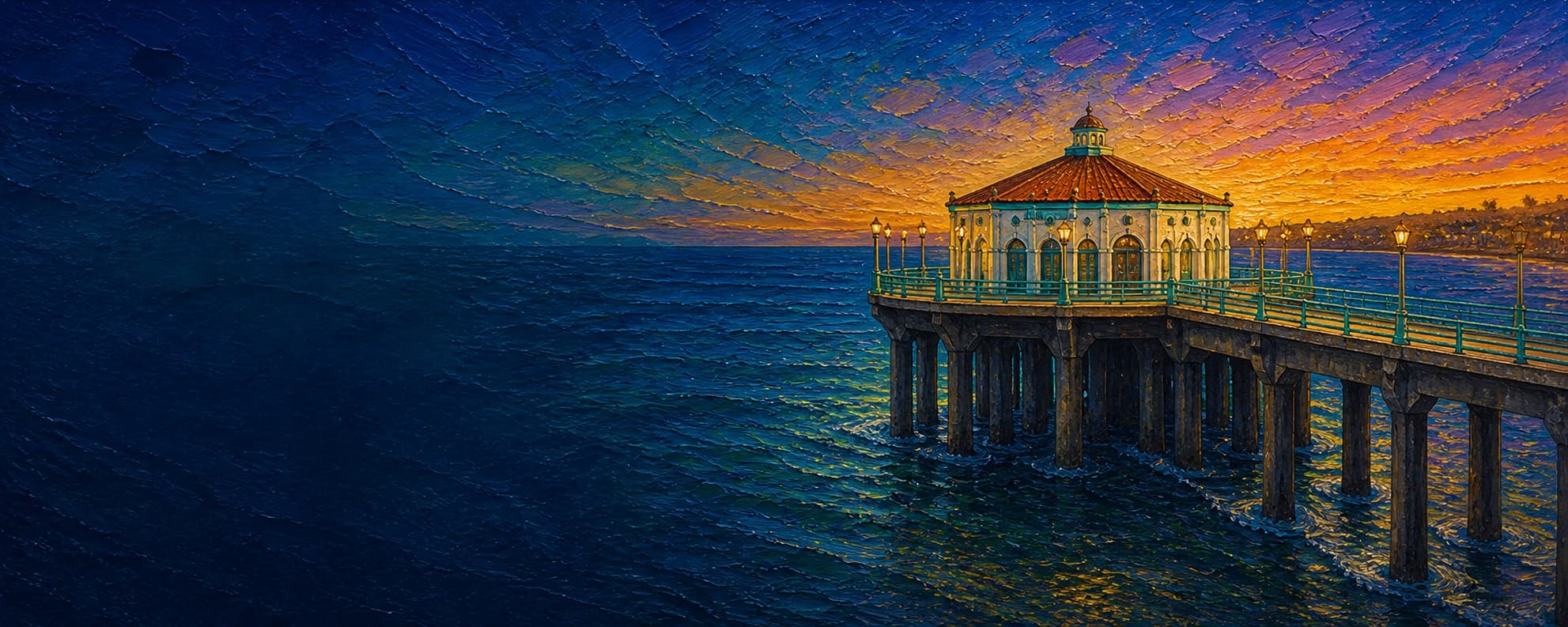
Manhattan Beach Pier (Manhattan Beach State Pier)
Manhattan Beach, California

Fishing conditions
Loading…
National Weather Service (api.weather.gov)
Loading…
NOAA CO-OPS predictions, station 9410777
- Sunrise—
- Sunset—
Dawn/dusk and a moving tide (the hour around a high or low) typically bring the most active bite — worth timing a trip around whichever falls closest to first/last light.
Loading…
Loading buoy telemetry…
NOAA National Data Buoy Center
A straight, steel-reinforced concrete deck and piling structure ending in a widened rounded platform around the octagonal, Mediterranean-style Roundhouse Aquarium. California Historical Landmark No. 1018 preserves it as Southern California's oldest remaining example of early reinforced-concrete pier construction. The current deck and much of the support structure date to the 1992 rehabilitation; the sea-foam-green rail system is aluminum, selected to retain the historic appearance while improving corrosion resistance.
Species & regulations
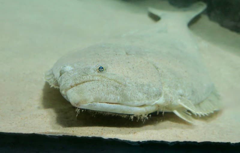
Fish a live smelt, small sardine, queenfish, or small mackerel near the sandy bottom from mid-pier; the local guide suggests whole or cut anchovy when live bait is unavailable.
⚠ OEHHA (Santa Monica Pier to Seal Beach Pier): women 18-49 and children 1-17 may eat 1 serving per week; women 50+ and men 18+ may eat 2 servings per week.
Photo: RatioTile · CC BY-SA 4.0
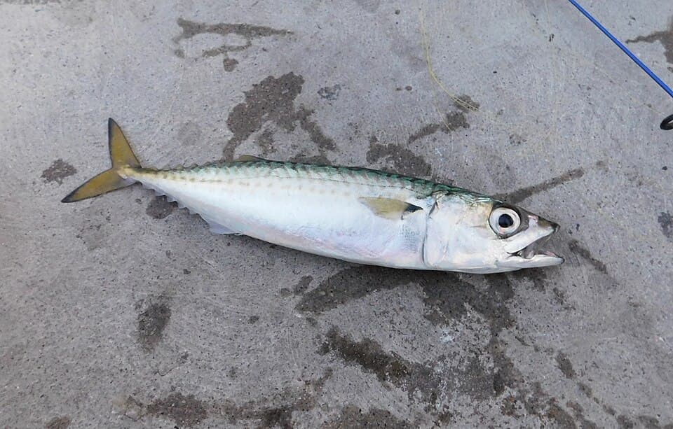
Use a small high/low rig or bait-catching rig from the outer half when schools move through; a small piece of mackerel or other bait can help when fish are not striking bare lures.
⚠ OEHHA (Santa Monica Pier to Seal Beach Pier): women 18-49 and children 1-17 may eat 2 servings per week; women 50+ and men 18+ may eat 4 servings per week.
Photo: Ruff tuff cream puff · CC0 1.0
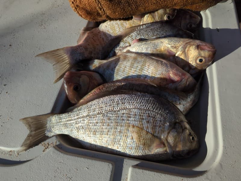
Fish sand crabs, bloodworms, mussels, clams, or shrimp on the bottom in the inshore surf zone; the local guide favors winter through early spring.
⚠ OEHHA (Santa Monica Pier to Seal Beach Pier): up to 2 servings per week for both advisory groups (women 18-49/children 1-17 and women 50+/men 18+).
Photo: Andy Kleinhesselink · CC0 1.0
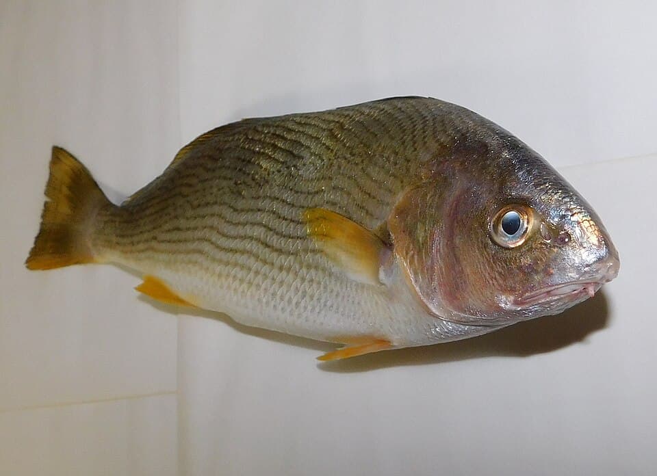
Use fresh mussels, clams, sand crabs, bloodworms, or shrimp on the sandy bottom; local reporting places them from the surf zone through mid-pier, especially in summer and fall.
⚠ OEHHA (Santa Monica Pier to Seal Beach Pier): up to 2 servings per week for both advisory groups (women 18-49/children 1-17 and women 50+/men 18+).
Photo: Ruff tuff cream puff · CC0 1.0
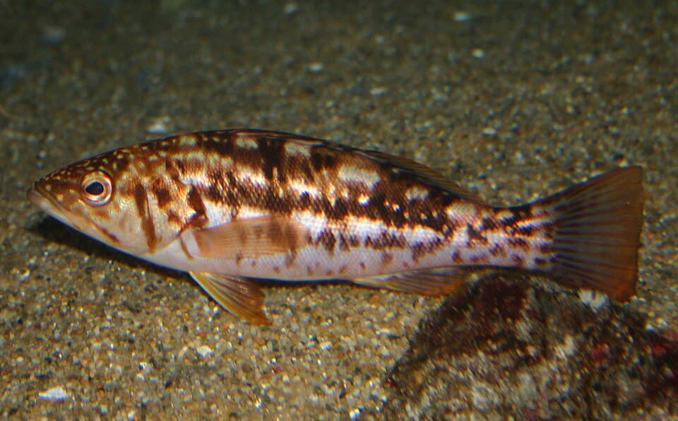
At the rounded end, fish a whole or cut anchovy near the quarry-rock reef; keep enough clearance from the structure to reduce snags.
⚠ OEHHA (Santa Monica Pier to Seal Beach Pier): up to 1 serving per week for both advisory groups (women 18-49/children 1-17 and women 50+/men 18+).
Photo: Steve Lonhart / Monterey Bay National Marine Sanctuary · Public domain (NOAA)
Small pieces of anchovy at mid-depth or near the sandy bottom produce this commonly reported mid-pier fish; release rather than retain because of the location-specific advisory.
⚠ DO NOT EAT fish caught between Santa Monica Pier and Seal Beach Pier. OEHHA gives the same do-not-eat advice to women 18-49, children 1-17, women 50+, and men 18+ because of mercury, DDT, or PCBs.
Bag/size limits sourced from CDFW's ocean sport fishing regulations — always double-check the current CDFW regs before keeping fish, as rules change.
Moon tracker
Recommended spots
- Rounded-end reef-facing rail
 Outer rail / artificial reef and pelagics
The strongest documented structural target: CDFW/Wildlife Conservation Board records establish a quarry-rock reef in the Manhattan Beach pier program, and the local guide places roughly 2,000 tons of rock about 65 ft from the end. Reports associate the outer rail with Pacific and jack mackerel, bonito, barracuda, kelp bass, sand bass, and California scorpionfish. The Roundhouse occupies the platform center, so usable rail and crowding still depend on the day.
- Inshore surf-zone rails

 Sandy surf / croaker and surfperch
The local pier guide identifies the sandy inshore water for barred surfperch, croakers, corbina, rays, and shovelnose guitarfish, with barred surfperch strongest from winter into early spring and croaker/corbina activity concentrated in summer and fall. Current Esri imagery confirms a broad breaking-wave band over sand. Productive species-specific water, but swimmers, surfers, breaking waves, and shallow depth reduce casting freedom.
- Mid-pier open-sand railOpen sandy bottom / halibut and croaker
The local guide places white croaker, queenfish, jacksmelt, yellowfin croaker, and occasional California halibut in the mid-pier zone and recommends live smelt or other small baitfish for halibut. The current aerial view shows open water away from the piling shadow and no discernible surface canopy here, giving a cleaner bottom-oriented cast than the piling pockets.
- Piling-adjacent pocketsConcrete structure / perch
Pier Fishing in California reports pileperch, walleye surfperch, silver surfperch, sargo, and salema around the pilings, with mussels or bloodworms as practical baits. The same mussel-covered concrete structure that attracts fish also raises snag and line-abrasion risk, so this is a targeted presentation beside—not directly into—the piling line.
Landmarks
- Pier entrance — Manhattan Beach Blvd & The Strand
 access
Landward access point at the west end of Manhattan Beach Boulevard. Coordinate is the CDFW/OES Manhattan Beach Pier facility point, not a surveyed gate position.
- Concrete piling line (mussel biofouling)
 hazard
Representative mid-pier point, interpolated along the centerline. Local reporting describes mussel-covered pilings; the Roundhouse explains that pier pilings support mussels, crabs, fish, and rays. Fish beside the structure but expect snag and abrasion risk close to it.
- Outer-pier fish-cleaning sinks
 amenity
Approximate outer-pier location, interpolated from sourced endpoints. The City's 2018 pier and Roundhouse improvement scope installed fish-cleaning sinks; verify the exact fixture location and availability on site.
- Roundhouse Aquarium and rounded end platform
 structure
Octagonal aquarium and marine-education facility at the pier's rounded seaward end, with public restrooms in the renovated building. Coordinate is the CDFW/OES Roundhouse facility point.
Vegetation / growth assessment
No rooted or surface kelp canopy is claimed. The current Esri World Imagery export shows open water around the pier with no clearly separable canopy patch; a long dark band tracks the pier and is consistent with structural shadow. CDFW records do confirm an artificial quarry-rock reef built in the 1960s, and both the local fishing guide and Roundhouse educational material document mussel/algal life on pier pilings. Because Kelpwatch's interactive site could not be queried here, CDFW aerial-survey polygons were not extracted for this exact site, and the reef's current footprint and vegetation cover were not independently imaged, the map zones are limited to light piling biofouling on both flanks. They should not be read as mapped kelp beds.
Piers grow algae, mussels, and barnacles on their pilings and along the deck edges over time — that build-up is what this section tracks. The more growth in a stretch, the easier it is for your hook, sinker, or line to catch on it and get stuck, which is one of the most common ways beginners lose tackle. Heavier growth isn't a reason to avoid a spot — it often holds bait and structure fish like — just expect to snag more and re-tie more often there.
Manhattan Beach Pier (Manhattan Beach State Pier)'s heaviest checked growth is still only light, on the left flank, mid-structure and the right flank, mid-structure — snag risk from vegetation is low across the structure right now.
- Left flank · noneunconfirmed, not yet assessed
No side-specific vegetation observation was independently verified here; gridded as checked, none confirmed.
- Right flank · noneunconfirmed, not yet assessed
No side-specific vegetation observation was independently verified here; gridded as checked, none confirmed.
- Left flank · lightsome growth, light snag risk
Facing seaward, this marks documented mussel/algal piling habitat rather than visible surface vegetation. Extent and intensity are generalized because individual pilings cannot be resolved consistently in the reviewed orbital image.
- Right flank · lightsome growth, light snag risk
Facing seaward, this mirrors the documented piling-biofouling habitat. Much of this flank is obscured by the pier shadow in the current Esri export, so no stronger intensity or canopy claim is warranted.

Reference sources
- CDFW/OES ACP Annex C — pier and Roundhouse coordinates
- City of Manhattan Beach — Pier Railings Replacement Project
- City of Manhattan Beach — 2025 pier condition and repair report
- California State Parks — Manhattan Beach State Pier landmark 1018
- City of Manhattan Beach — Roundhouse Aquarium Improvements
- Roundhouse Aquarium Teaching Center — official site
- Roundhouse Aquarium — Pier Piling Tank
- Wildlife Conservation Board — January 26, 1965 reef funding minutes
- Wildlife Conservation Board — March 23, 1972 pier-reef history
- CDFW — Artificial Fishing Reefs Constructed Around Public Piers
- Pier Fishing in California — Manhattan Beach Pier
- Esri World Imagery — reviewed export around Manhattan Beach Pier
- Kelpwatch.org — interactive kelp canopy map
- Kelpwatch.org — Landsat and Planet methodology
- CDFW — Aerial Kelp Surveys
- NOAA CO-OPS — El Segundo station 9410777
- NOAA CO-OPS — tide-prediction station metadata
- CDFW — current Southern California ocean regulations (updated July 2026)
- CDFW — general ocean finfish regulations (updated July 2026)
- CDFW — public-pier license exemption and two-rod rule
- OEHHA — Santa Monica Pier to Seal Beach Pier fish advisory
- Wikimedia Commons — California halibut photo and license
- Wikimedia Commons — Pacific chub mackerel photo and license
- Wikimedia Commons — barred surfperch photo and license
- Wikimedia Commons — yellowfin croaker photo and license
- Wikimedia Commons — kelp bass photo and public-domain status