
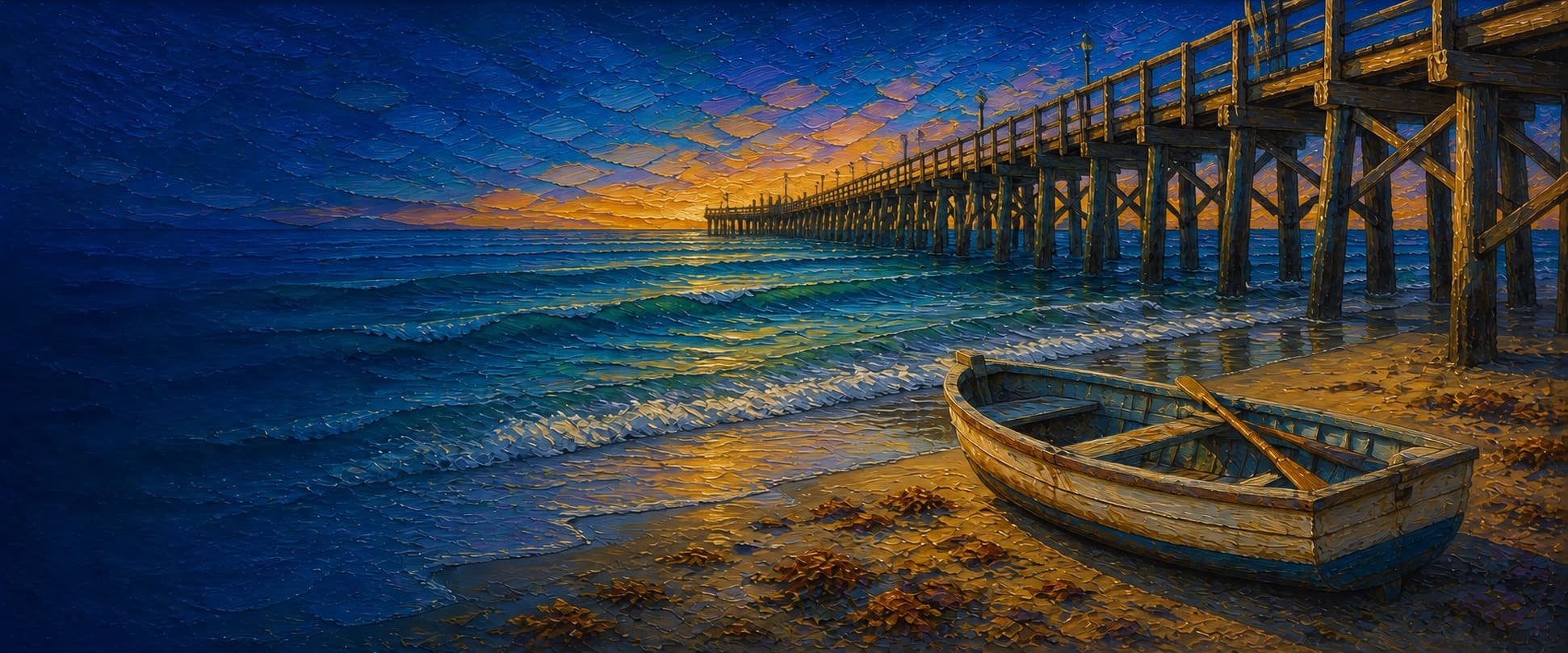
Newport Pier (Newport Municipal Pier / McFadden Wharf)
Newport Beach, California

Fishing conditions
Loading…
National Weather Service (api.weather.gov)
Loading…
NOAA CO-OPS predictions, station 9410580
- Sunrise—
- Sunset—
Dawn/dusk and a moving tide (the hour around a high or low) typically bring the most active bite — worth timing a trip around whichever falls closest to first/last light.
Loading…
Loading buoy telemetry…
NOAA National Data Buoy Center
A 1,032-foot concrete-surfaced municipal pier with a widened square outer platform. Local fishing guidance places roughly 30 feet of water at its end and the Newport Submarine Canyon a short distance offshore. The historic Newport Dory Fishing Fleet operates on the beach beside the shore end; do not confuse this pier with Balboa Pier farther southeast on the peninsula.
Species & regulations
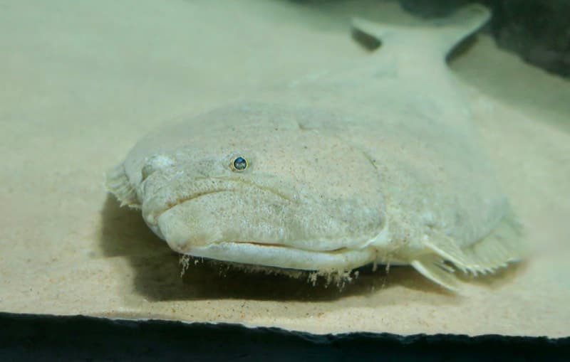
Fish a legal live bait or other bottom presentation just past the surf zone through mid-pier, the area identified in the local report as best for halibut.
⚠ OEHHA provides coastal consumption guidance for this area; consult the current Southern California advisory before eating retained fish.
Photo: RatioTile · CC BY-SA 4.0
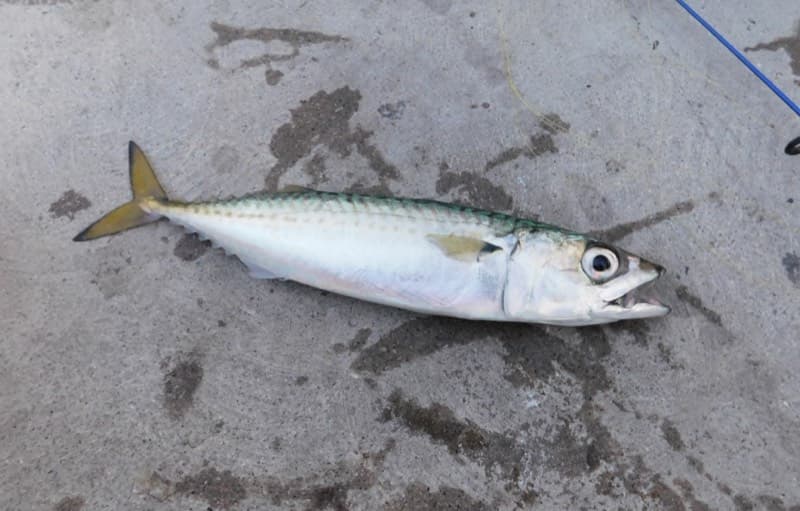
The outer rail is the reported pelagic zone. Use a Sabiki or a small bait strip around visible schools and avoid casting across other anglers' lines.
⚠ OEHHA provides coastal consumption guidance for this area; consult the current Southern California advisory before eating retained fish.
Photo: Ruff tuff cream puff · CC0 (public domain dedication)
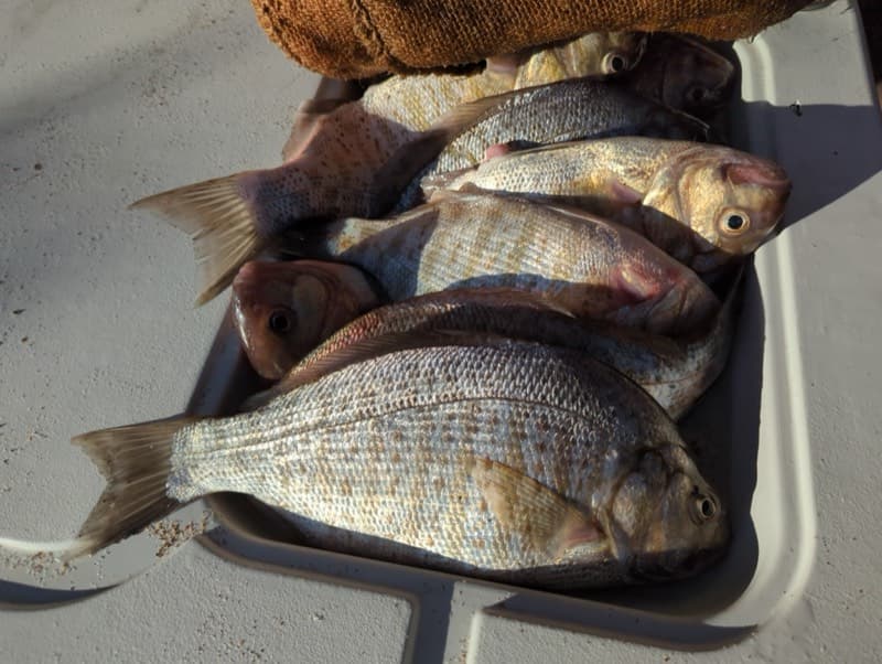
Fish sand crabs, mussel, or worms in the inshore wash; the local report names barred surfperch in the first quarter of the pier.
⚠ OEHHA provides coastal consumption guidance for this area; consult the current Southern California advisory before eating retained fish.
Photo: Zack Abbey · CC BY 4.0
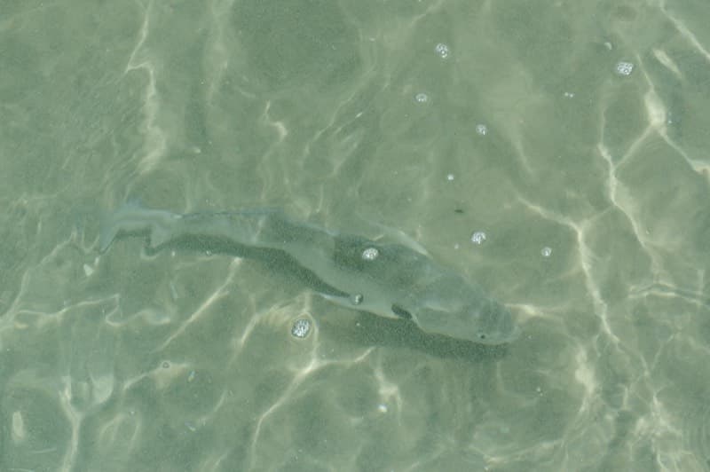
Work a small bottom bait in the sandy inshore water; spotfin croaker are specifically reported from the surf to about one-quarter of the pier.
Photo: Donald Davesne · CC BY 4.0
Small bottom baits in the mid-pier piling area can catch white croaker; identify fish carefully before retaining any.
⚠ OEHHA's Southern California coastal advisory has location- and species-specific consumption guidance; check its current white-croaker recommendation before eating fish caught here.
Bag/size limits sourced from CDFW's ocean sport fishing regulations — always double-check the current CDFW regs before keeping fish, as rules change.
Moon tracker
Recommended spots
- Just-past-surf bottom lane
 Bottom / California halibut
Pier Fishing in California calls the water just past the surf zone through midway the best area for halibut. Work a legal live bait or other bottom presentation away from the pile line; bite quality naturally varies with conditions.
- Outer-platform railPelagic / deepest pier water
The end is reported as best for Pacific and jack mackerel, sardines, and occasional bonito or barracuda, with deeper-water bottom fish also possible because of the nearby submarine canyon. It is the strongest all-purpose open-water rail, subject to crowding and wind.
- Inshore surf zone

 Surf / croaker and surfperch
The local pier guide specifically places barred surfperch, yellowfin and spotfin croaker, and occasional corbina in the surf through roughly the first quarter of the pier. Fish the sandy wash while giving swimmers and surf users wide room.
- Mid-pier piling edgeStructure / perch and croaker
The report identifies mid-pier as productive for several perch, jacksmelt, queenfish, and white croaker, and describes food-rich mussel and barnacle growth on the piles. Fish adjacent to, rather than into, the encrusted structure.
- Outer northwest cornerNight / ray and deep-water opportunity
The local guide singles out the far-right corner for some deep-water catches and reports large sharks and bat rays at the end, generally at night. This conditional spot should not be treated as a guaranteed bite; posted closing hours may preclude night fishing.
Landmarks
- Newport Pier entrance — McFadden Place
 access
Accessible ramp and limited paid parking are reported near the entrance; confirm current parking rates, closures, and posted pier hours on arrival.
- Pier-entry restrooms
 amenity
A restroom building is mapped at 72 Newport Pier; the local pier guide also places restrooms near the entrance.
- Newport Beach Lifeguard Headquartersamenity
Mapped immediately beside the shore end. Keep tackle and casts clear of lifeguard operations and follow all posted beach restrictions.
- Newport Dory Fleet Market
 structure
The City identifies the historic Dory Fishing Fleet and open-air fish market next to Newport Pier; the fleet dates to 1891. Market operation and beach access are variable.
- McFadden (Newport) Wharf historical markerstructure
Mapped historical plaque commemorating the original 1888 wharf at the shore end of the modern pier.
- Outer platform / piling field
 hazard
The outer rail has the deepest pier water, but local reporting describes heavily mussel- and barnacle-encrusted piles. Keep lines just clear of the structure to reduce snags.
Vegetation / growth assessment
A reviewed Esri World Imagery export shows open ocean and sandy surf without a clearly identifiable floating kelp canopy. Pier Fishing in California describes the pilings as having little kelp but being heavily encrusted with barnacles and mussels. That supports structure-associated biofouling, but neither source resolves its seasonality, below-surface extent, or a defensible left-versus-right distribution; the zones below are deliberately symmetric and cautious.
Piers grow algae, mussels, and barnacles on their pilings and along the deck edges over time — that build-up is what this section tracks. The more growth in a stretch, the easier it is for your hook, sinker, or line to catch on it and get stuck, which is one of the most common ways beginners lose tackle. Heavier growth isn't a reason to avoid a spot — it often holds bait and structure fish like — just expect to snag more and re-tie more often there.
The most growth on Newport Pier (Newport Municipal Pier / McFadden Wharf) is on the left flank (its full length) and the right flank (its full length) — expect occasional snags there; nothing else on the structure reads heavier.
- Left flank · noneunconfirmed, not yet assessed
No side-specific vegetation observation was independently verified here; gridded as checked, none confirmed.
- Right flank · noneunconfirmed, not yet assessed
No side-specific vegetation observation was independently verified here; gridded as checked, none confirmed.
- Left flank · moderatemoderate growth, expect occasional snags
Piling biofouling is reported generally, not mapped by flank. Moderate denotes the reported mussel/barnacle structure, not a verified surface kelp bed.
- Right flank · moderatemoderate growth, expect occasional snags
Same conservative, non-side-specific interpretation of the local piling report; submerged growth cannot be resolved from the checked imagery.
- Outer end · lightsome growth, light snag risk
Approximate outer-platform width from the OSM footprint. No independent end-cap canopy observation was found; light is a baseline rather than a clean-bottom claim.

Reference sources
- OpenStreetMap — Newport Pier way 13372739
- OpenStreetMap API — Newport Pier geometry and tags
- OpenStreetMap Nominatim — Newport Pier
- Pier Fishing in California — Newport Pier / McFadden Wharf
- City of Newport Beach — historical resources (McFadden Wharf and Dory Fleet)
- Newport Beach Historical Society — McFadden Square marker
- NOAA CO-OPS — Newport Beach, Newport Bay Entrance station 9410580
- CDFW — California recreational ocean fishing regulations
- CDFW — 2026 California ocean sport fishing regulations booklet
- CDFW — beach and public-pier fishing
- OEHHA — Southern California coastal fish advisory
- Esri World Imagery service
- Kelpwatch methodology
- CDFW — aerial kelp surveys
- Wikimedia Commons — California halibut photo
- Wikimedia Commons — Pacific mackerel photo
- Wikimedia Commons — barred surfperch photo
- Wikimedia Commons — spotfin croaker photo