
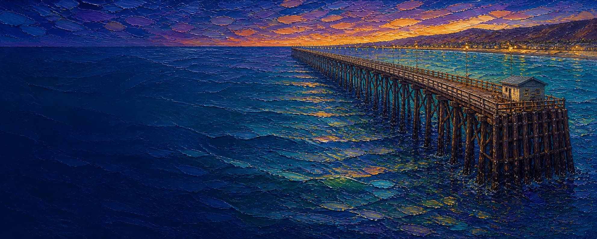
Oceanside Pier (Oceanside Municipal Pier)
Oceanside, California

Fishing conditions
Loading…
National Weather Service (api.weather.gov)
Loading…
NOAA CO-OPS predictions, station 9410230
- Sunrise—
- Sunset—
Dawn/dusk and a moving tide (the hour around a high or low) typically bring the most active bite — worth timing a trip around whichever falls closest to first/last light.
Loading…
Loading buoy telemetry…
NOAA National Data Buoy Center
The current pier is a 1,954-foot wooden pier with a concrete approach. The 1927 pier/approach history is documented by the Oceanside Chamber; the current timber structure was built in 1985–87, uses diagonal wooden decking, and was raised about three feet at the end. A fire on April 25, 2024 destroyed the vacant west-end restaurant and Brine Box. The city reopened roughly 90% of the pier, but the far-west hammerhead remains closed beyond the bait shop, restrooms, and fish-cleaning station. Debris removal finished in February 2025; hammerhead engineering design was awarded in April 2026, with design expected in September 2026 and construction potentially beginning in spring 2027. The leaseholder has expressed an intent to rebuild the restaurant, but has not published a firm reopening date.
Species & regulations
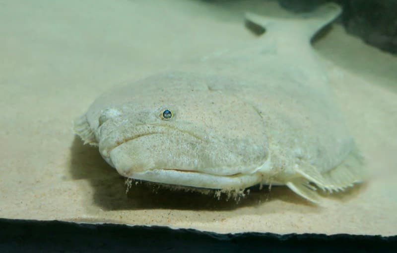
Live anchovy, smelt, or a strip of mackerel fished close to bottom around piling depressions.
Photo: RatioTile · CC BY-SA 4.0
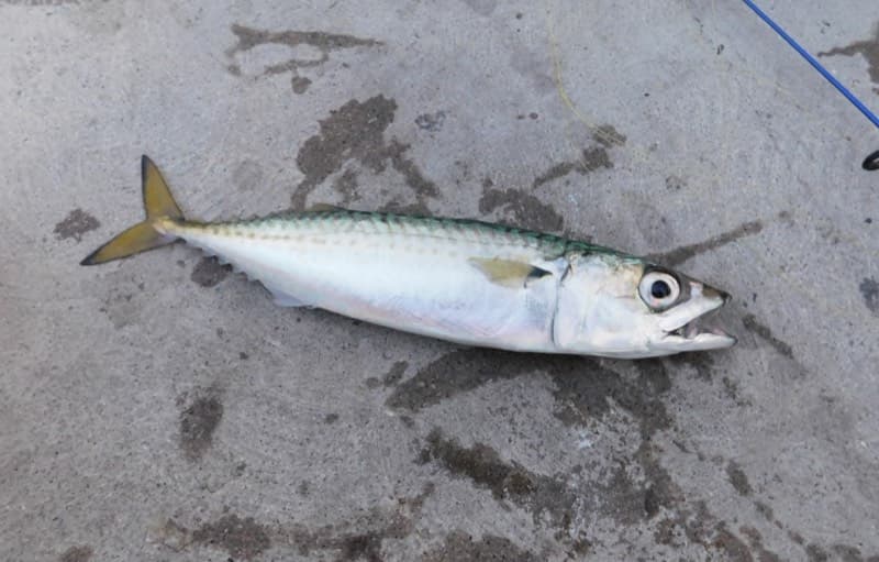
Sabiki or other small-feather rigs, small spoons, or squid strips; dawn, dusk, and evening are productive windows.
Photo: Ruff tuff cream puff · CC0
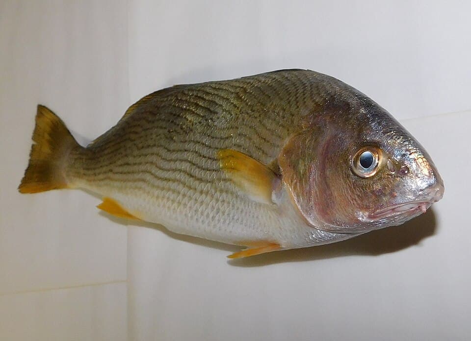
Sand crabs, mussels, or bloodworms fished on bottom over the sandy inshore zone.
⚠ OEHHA's statewide California-coast advisory limits the croaker group to 2 servings per week for women 18–45 and children 1–17, or 4 servings per week for older women and men; follow the current OEHHA poster.
Photo: Ruff tuff cream puff · CC0
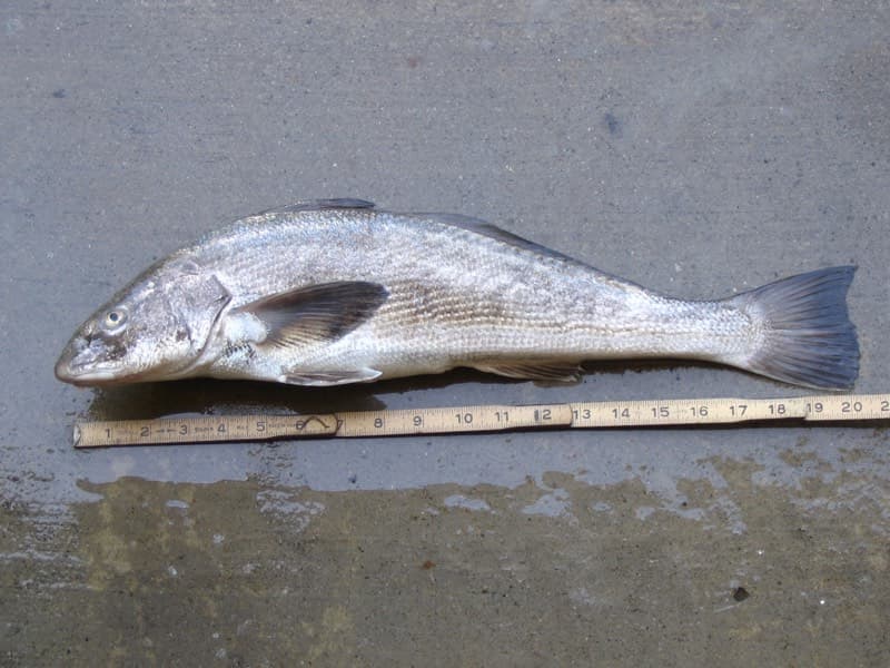
Sand crabs or bloodworms in the wash and shallow sandy water near the base.
⚠ OEHHA's statewide California-coast advisory recommends no more than 1 serving per week for both sensitive and general populations.
Photo: N1ywb · CC BY-SA 3.0
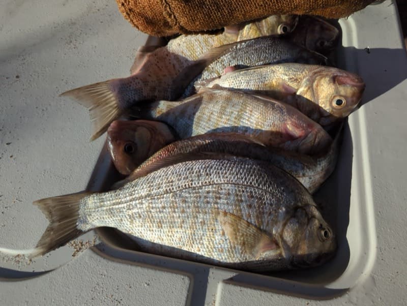
Sand crabs, bloodworms, or small mussel baits in the surf wash and along the sandy bottom.
⚠ OEHHA's very-low-PCB surfperch group recommendation is 2 servings per week for sensitive populations and 6 per week for the general population.
Photo: Matt Muir · CC BY 4.0
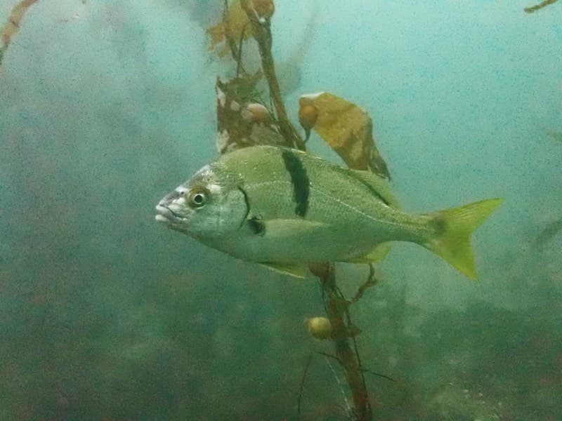
Mussel, ghost shrimp, or bloodworm baits near pilings and the current around the mid-pier offset.
Photo: Donald Davesne (iNaturalist) · CC BY 4.0
Bag/size limits sourced from CDFW's ocean sport fishing regulations — always double-check the current CDFW regs before keeping fish, as rules change.
Moon tracker
Recommended spots
- Mid-pier halibut drift
 California halibut
Pierfishing identifies halibut as common from mid-pier to near the end, especially May–July but year-round, with fish holding in depressions between pilings. Fish only within the currently open section.
- Inshore surf zone

 Surfperch and croaker water
Pierfishing reports barred surfperch, corbina, yellowfin and spotfin croaker, rays, and guitarfish near the sandy base. Sand crabs, ghost shrimp, bloodworms, or mussel make credible bottom baits; surf and beach crowds are the main constraints.
- Bait-shop offsetMixed mid-pier water
Local reports place halibut, croaker, sargo, rays, guitarfish, smelt, and bass from the bait-shop area toward mid-pier. This coordinate is an approximate OSM-centerline placement, not a surveyed storefront pin.
- Last-open deeper offsetMackerel and smelt water
The local report places Pacific mackerel, jack mackerel, sardines, bonito in some years, barracuda, seabass, sharks, and rays toward the deep end. This is the closest useful proxy before the official hammerhead barricade; stop at the closure.
- Closed hammerheadClosed structure / hazard
The city says the fire-damaged west end is closed pending deck, rail, and hammerhead work. This is not a fishable spot until the city formally reopens it.
Landmarks
- Pier View Way entrance
 access
City access is generally 4:00 a.m.–10:00 p.m.; the entrance and most of the pier are open, subject to the west-end closure.
- Junior Seau Pier Amphitheatre
 amenity
Outdoor amphitheater below the pier entrance, mapped by OpenStreetMap and identified on the city's pier page.
- Oceanside City Beachaccess
The pier projects from the broad sandy Oceanside City Beach; the inshore fishing zone is surf and sand rather than a mapped reef.
- Bait shop, restrooms, and fish-cleaning station offsetamenity
Approximate centerline point: the city identifies these facilities as the last currently open offset. The storefront point was not independently mapped.
- Oceanside Lifeguard Serviceamenity
Mapped at the beach-side entrance area; use posted beach and pier safety instructions.
- Fire-damaged hammerhead closure
 hazard
Official city notices say the far west end is closed after the April 2024 fire. Do not pass barricades; deck and rail restoration is pending.
Vegetation / growth assessment
Kelpwatch custom-area aggregates returned 0 m² mapped canopy for every Landsat quarter from 1984 through 2024 and every Planet September snapshot from 2017 through 2024 in a small polygon around the pier. That result supports no mapped emergent canopy in the selected area, not the absence of submerged kelp, seasonal algae, or piling biofouling. Pierfishing specifically documents mussels, crabs, and shrimp on pilings. The fire-damaged hammerhead is closed and its rebuilt substrate is unknown.
Piers grow algae, mussels, and barnacles on their pilings and along the deck edges over time — that build-up is what this section tracks. The more growth in a stretch, the easier it is for your hook, sinker, or line to catch on it and get stuck, which is one of the most common ways beginners lose tackle. Heavier growth isn't a reason to avoid a spot — it often holds bait and structure fish like — just expect to snag more and re-tie more often there.
Oceanside Pier (Oceanside Municipal Pier)'s heaviest checked growth is still only light, on the right flank, mid-structure, the left flank, mid-structure, and the outer end — snag risk from vegetation is low across the structure right now.
- Left flank · noneunconfirmed, not yet assessed
No side-specific vegetation observation was independently verified here; gridded as checked, none confirmed.
- Left flank · noneunconfirmed, not yet assessed
No side-specific vegetation observation was independently verified here; gridded as checked, none confirmed.
- Right flank · noneunconfirmed, not yet assessed
No side-specific vegetation observation was independently verified here; gridded as checked, none confirmed.
- Right flank · noneunconfirmed, not yet assessed
No side-specific vegetation observation was independently verified here; gridded as checked, none confirmed.
- Right flank · lightsome growth, light snag risk
No mapped canopy in the Kelpwatch area; piling biofouling is documented, but flank intensity was not directly observed.
- Left flank · lightsome growth, light snag risk
Sandy beach baseline and no mapped canopy; no interactive satellite inspection was available for a finer near-pier distinction.
- Outer end · lightsome growth, light snag risk
The hammerhead is closed after the fire; no direct vegetation observation is possible and repair work may change the end substrate.

Reference sources
- City of Oceanside pier page
- City fire recovery update (April 15, 2026)
- City Legistar hammerhead design contract
- OpenStreetMap pier geometry
- OpenStreetMap Overpass amenities
- Oceanside Chamber pier history
- Visit Oceanside pier history
- Pierfishing Oceanside report
- Visit Oceanside fishing guide
- CDFW Southern California regulations
- CDFW general ocean regulations
- CDFW public pier license guidance
- CDFW 2026 ocean regulations booklet
- NOAA La Jolla station
- NOAA tide station metadata
- Kelpwatch methodology
- Kelpwatch Landsat custom aggregate
- Kelpwatch Planet custom aggregate
- CDFW aerial kelp surveys
- OEHHA coastal fish advisory
- OEHHA coastal advisory PDF
- California halibut photo (Wikimedia)
- Pacific mackerel photo (Wikimedia)
- Yellowfin croaker photo (Wikimedia)
- California corbina photo (Wikimedia)
- Barred surfperch photo (iNaturalist)
- Sargo photo (iNaturalist)