
Port Hueneme Pier (Port Hueneme Fishing Pier)
Port Hueneme, California
Fishing conditions
Loading…
National Weather Service (api.weather.gov)
Loading…
NOAA CO-OPS predictions, station 9411065
- Sunrise—
- Sunset—
Dawn/dusk and a moving tide (the hour around a high or low) typically bring the most active bite — worth timing a trip around whichever falls closest to first/last light.
Loading…
Loading buoy telemetry…
NOAA National Data Buoy Center
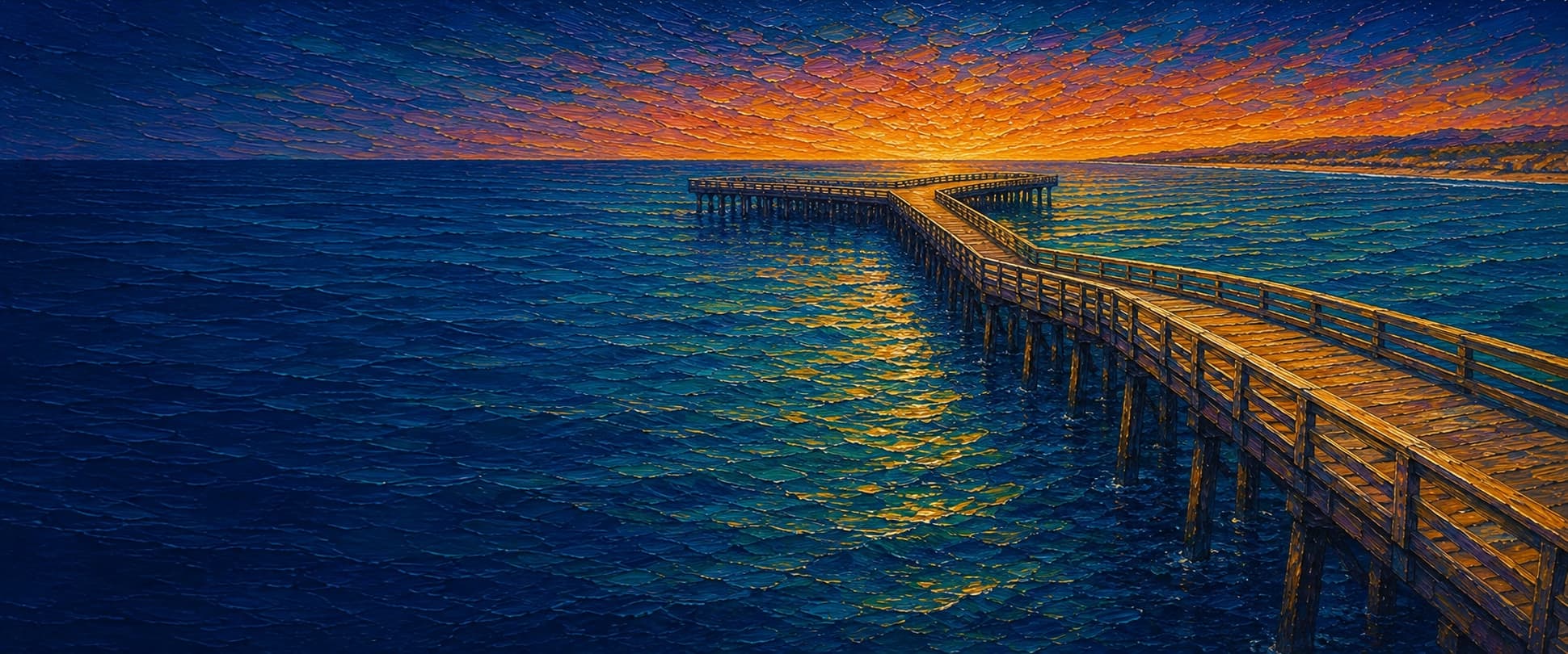
Wooden, zigzag-shaped public fishing pier in Port Hueneme Beach Park. The City says the 1956 650-ft sewer-outfall construction trestle was altered in 1968: about 300 ft of the old pier was removed and a 900-ft extension offset to avoid the outfall, creating the conspicuous transition. Storms removed both original T-end wings; the present storm-resistant hourglass terminus was built in 1999. The City lists the pier as 1,250 ft; Pier Fishing in California reported 1,400 ft and a 24-ft deck in 2018, an unresolved difference retained in the confidence notes.
Species & regulations
The local report identifies the mid-pier-to-end piling depressions as the main halibut area; fish a small live smelt, shinerperch, queenfish, or sardine close to bottom where legal and available.
⚠ OEHHA's Ventura Harbor–Santa Monica Pier guidance: women 18–45 and children 1–17 should eat no more than one serving/week; women over 45 and men no more than two servings/week. Do not combine servings across categories.
When schools are present, fish a multi-hook bait rig with small bait strips from the outer rail or along the pier; Pacific mackerel are specifically reported from the end and most pier areas.
⚠ OEHHA's Ventura Harbor–Santa Monica Pier guidance allows up to two servings/week for women 18–45 and children 1–17, and up to four servings/week for women over 45 and men; do not combine categories.
Fish small anchovy, worm, or shrimp pieces near the surface to mid-depth on a multi-hook rig around the pilings or outer end; the local report calls jacksmelt one of the consistent school fish when present.
⚠ OEHHA's Ventura Harbor–Santa Monica Pier guidance allows up to four servings/week for women 18–45 and children 1–17, and up to seven servings/week for women over 45 and men; do not combine categories.
Fish sand crabs, bloodworms, fresh mussel, or ghost shrimp near the inshore sand and piling line. The local report says the inshore surfperch action is present but not especially strong, particularly compared with pelagics.
⚠ OEHHA's Ventura Harbor–Santa Monica Pier guidance allows up to two servings/week for women 18–45 and children 1–17, and up to two servings/week for women over 45 and men; do not combine categories.
Use cut anchovy or seaworms on the deeper sandy bottom from mid-pier outward; the local report identifies white croaker in deeper water.
⚠ OEHHA's Ventura Harbor–Santa Monica Pier guidance: women 18–45 and children 1–17 should eat no more than one serving/week; women over 45 and men no more than two servings/week. Do not combine servings across categories.
Bag/size limits sourced from CDFW's ocean sport fishing regulations — always double-check the current CDFW regs before keeping fish, as rules change.
Moon tracker
Recommended spots
- Mid-to-outer piling depressions
 Piling structure / live-bait presentations
The local report says mid-pier-to-end depressions among the pilings produce most halibut, commonly on small live smelt, shinerperch, queenfish, or sardine. Keep clear of the mussel-covered piles to reduce snags.
- Outer hourglass railDeepest water / pelagic and crab opportunity
The end adds Pacific mackerel, jack mackerel, and sardines to the mid-pier mix, according to the local report; it also identifies the end as the best area for spider crabs. The open terminus offers the broadest casting angles, subject to wind and crowding.
- Mid-pier sandy bottom

 Halibut, croaker, rays, and baitfish
Pier Fishing in California places halibut, white croaker, thornbacks, guitarfish, and bat rays in the mid-pier area, with small smelt, shinerperch, and queenfish available on bait rigs. It identifies this sandy bottom as one of the better areas for large bat rays.
- Inshore sandy surf zoneShallow surfperch / croaker water
The local pier report describes some barred surfperch and yellowfin/spotfin croaker near shore, but explicitly rates the inshore action as not especially good. Use sand crabs, worms, mussel, or ghost shrimp in the sandy wash when conditions permit.
Landmarks
- Port Hueneme Pier entrance
 access
Shore-end access at Port Hueneme Beach Park. The City posts daily pier hours of 6 a.m.–10 p.m.; confirm current closures and ordinances before visiting.
- Port Hueneme Beach Park picnic and play area
 amenity
The City documents BBQ/picnic areas, swings, volleyball nets, and beach-lot parking adjoining the pier; this is a generalized placement rather than a surveyed amenity point.
- Pier-front restroomsamenity
The City lists restrooms at the front of the pier and in parking lot A. Exact building coordinates were not independently verified.
- Old/new pier offset transition
 structure
The large transition was created when the 1968 extension was offset to avoid driving piles into the abandoned sewer outfall.
- Hourglass-shaped outer terminusstructure
The current terminus was built in 1999 after winter storms removed the earlier T-end wings; it is intended to resist storm damage.
- Storm-exposed outer pier
 hazard
The City documents major storm damage in 1995 and 1997, including loss of the original terminus wings. Obey posted restrictions during swell, repairs, or closures.
Vegetation / growth assessment
Pier Fishing in California reports primarily sandy bottom, pilings generally well covered with mussels, and considerable kelp/seaweed around the end in summer. No reviewed source supplied a current, side-specific piling-fouling or canopy survey, so both flanks use the same cautious qualitative zone and the seasonal end zone is not a claim of persistent kelp.
Piers grow algae, mussels, and barnacles on their pilings and along the deck edges over time — that build-up is what this section tracks. The more growth in a stretch, the easier it is for your hook, sinker, or line to catch on it and get stuck, which is one of the most common ways beginners lose tackle. Heavier growth isn't a reason to avoid a spot — it often holds bait and structure fish like — just expect to snag more and re-tie more often there.
The most growth on Port Hueneme Pier (Port Hueneme Fishing Pier) is on the left flank, mid-structure, the right flank, mid-structure, and the outer end — expect occasional snags there; nothing else on the structure reads heavier.
- Left flank · noneunconfirmed, not yet assessed
No side-specific vegetation observation was independently verified here; gridded as checked, none confirmed.
- Left flank · noneunconfirmed, not yet assessed
No side-specific vegetation observation was independently verified here; gridded as checked, none confirmed.
- Right flank · noneunconfirmed, not yet assessed
No side-specific vegetation observation was independently verified here; gridded as checked, none confirmed.
- Right flank · noneunconfirmed, not yet assessed
No side-specific vegetation observation was independently verified here; gridded as checked, none confirmed.
- Left flank · moderatemoderate growth, expect occasional snags
Mussel cover on the pilings is documented, but its density and side-specific distribution were not mapped; moderate is a cautious, non-directional interpretation.
- Right flank · moderatemoderate growth, expect occasional snags
Same documented piling habitat; no source supports a left/right difference in fouling extent.
- Outer end · moderatemoderate growth, expect occasional snags
The local report describes considerable kelp and seaweed around the end in summer. Width is an approximate display span for the mapped hourglass platform, not a surveyed vegetation boundary.

Reference sources
- City of Port Hueneme — Port Hueneme Pier (history, hours, facilities)
- Pier Fishing in California — Port Hueneme Pier (structure, bottom, vegetation, fishing)
- OpenStreetMap — Port Hueneme Fishing Pier, way 10738427 (mapped geometry)
- OpenStreetMap Nominatim — Port Hueneme Fishing Pier search result
- NOAA CO-OPS — Port Hueneme tide predictions, station 9411065
- NOAA CO-OPS Metadata API — Port Hueneme station 9411065
- CDFW — California Beach Fishing / public-pier rules and Ventura County pier list
- CDFW — California recreational ocean fishing regulations (current limits and gear rules)
- CDFW — current ocean sport fishing regulations and species limits
- OEHHA — Southern California coastal fish consumption advisory
- Kelpwatch — California kelp-canopy map
- CDFW — Aerial Kelp Surveys